Skip to main content
Main navigation
Finding Aids
Digital Projects
African American Experience in Las Vegas
Charles Saladino Landscape Architecture Collection
Culinary Union Photograph Collection
Dino at the Sands
Dreaming the Skyline
Entertainment
Historic Landscape of Nevada
Hoover Dam
Jamey Stillings
Menus: The Art of Dining
Nevada Test Site Oral History Project
Newspapers
Oral Histories Collection
Photograph Collections
Rebel Yell Newspaper
Showgirls
Southern Nevada: The Boomtown Years 1900-1925
Southern Nevada History in Maps
Southern Nevada Jewish Heritage Project
UNLV CSUN Records
Union Pacific Railroad Water Documents
Walking Box Ranch Collection
Welcome Home Howard
About
Request Images
Help
Provide Feedback
Special Collections Home
Search the Special Collections and Archives Portal
Search
Search
Breadcrumb
Home
Still Image
A static visual representation
Authority Sources
DCMI Type Vocabulary
Maps of Las Vegas metropolitan area, Grand Canyon National Park and national parks near Las Vegas, Nevada, 2008, side 2
Image
View
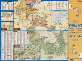
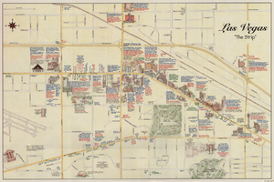
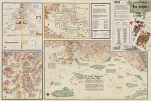
Maps of the Las Vegas Strip, downtown and metropolitan Las Vegas area, the Grand Canyon and southern Nevada, circa 1997
Text
View
Maps of the Las Vegas Strip, downtown and metropolitan Las Vegas area, the Grand Canyon and southern Nevada, circa 1997, side 1
Image
View
Maps of the Las Vegas Strip, downtown and metropolitan Las Vegas area, the Grand Canyon and southern Nevada, circa 1997, side 2
Image
View
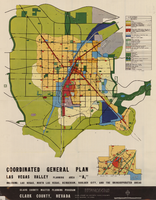
Map showing coordinated general plan for Las Vegas Valley, Planning Area A5, circa 1965-1968
Text
View
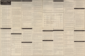
Map showing coordinated general plan for Las Vegas Valley, Planning Area A5, circa 1965-1968, side 1
Image
View
Map showing coordinated general plan for Las Vegas Valley, Planning Area A5, circa 1965-1968, side 2
Image
View
Map showing proposed metropolitan Las Vegas development area, June 24, 1997
Image
View
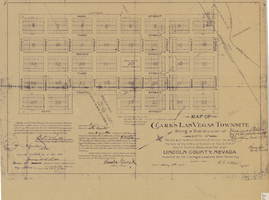
Map of Clark's Las Vegas Townsite, May 8, 1905
Text
View
Map of Las Vegas and vicinity, Clark County, Nevada, November 1952
Image
View
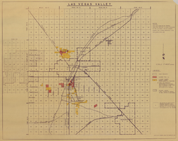
Las Vegas Valley map, Clark County, Nevada, June 1958
Image
View
Map of Las Vegas Valley, 1968
Image
View
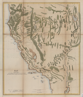
Map showing the different routes travelled over by the detachments of the Overland Command in the spring of 1855 from Salt Lake City, Utah, to the Bay of San Francisco, 1855
Image
View
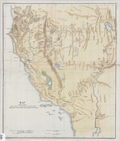
Map showing the different routes travelled over by the detachments of the Overland Command in the spring of 1855 from Salt Lake City, Utah, to the Bay of San Francisco, 1855
Image
View
Map of part of south western Colorado, January 10, 1878
Image
View
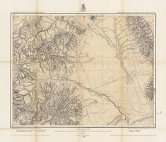
Map of economical features of parts of southern Colorado and northern New Mexico, January 8, 1878
Image
View
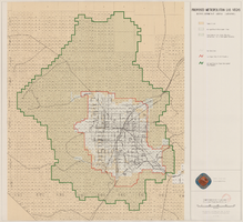
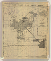
Map of Las Vegas Valley, Clark County, Nevada, circa 1950-1956
Image
View
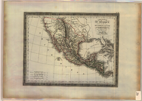
Map of Mexico and Central America, 1826
Image
View
Pagination
First page
« First
Previous page
‹‹
…
Page
2127
Page
2128
Page
2129
Page
2130
Current page
2131
Page
2132
Page
2133
Page
2134
Page
2135
…
Next page
››
Last page
Last »