Skip to main content
Main navigation
Finding Aids
Digital Projects
African American Experience in Las Vegas
Charles Saladino Landscape Architecture Collection
Culinary Union Photograph Collection
Dino at the Sands
Dreaming the Skyline
Entertainment
Historic Landscape of Nevada
Hoover Dam
Jamey Stillings
Menus: The Art of Dining
Nevada Test Site Oral History Project
Newspapers
Oral Histories Collection
Photograph Collections
Rebel Yell Newspaper
Showgirls
Southern Nevada: The Boomtown Years 1900-1925
Southern Nevada History in Maps
Southern Nevada Jewish Heritage Project
UNLV CSUN Records
Union Pacific Railroad Water Documents
Walking Box Ranch Collection
Welcome Home Howard
About
Request Images
Help
Provide Feedback
Special Collections Home
Search the Special Collections and Archives Portal
Search
Search
Breadcrumb
Home
Still Image
A static visual representation
Authority Sources
DCMI Type Vocabulary
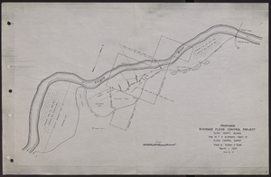
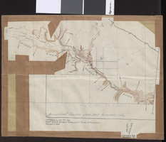
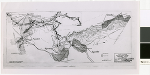
Map of proposed flood control project on the Virgin River in Clark County, Nevada, March, 1934
Image
View
Map of general plan for the Wells Siding Project in Logandale, Nevada, May 15, 1935
Image
View
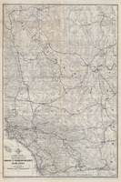
Map of water pipelines owned by or to be sold to the Las Vegas Valley Water District, March 1, 1953
Image
View
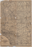
Map of a portion of southern California and southwestern Nevada embracing the arid region of Mojave & Colorado Deserts including Death Valley, circa 1936
Image
View
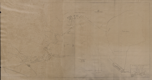
Topographic map of Arrow Canyon dam and reservoir site on the Muddy River, 1934, side 1
Image
View
Topographic map of Arrow Canyon dam and reservoir site on the Muddy River, 1934, side 2
Image
View
Map of a portion of southern California and southwestern Nevada embracing the arid region of Mojave & Colorado Deserts including Death Valley, circa 1937
Image
View
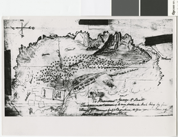
Hand-drawn map of the Mormon Fort and Las Vegas Valley from a letter by John Steele to Brigham Young, circa 1855
Image
View
Map of farm plots of the Las Vegas Mormon Mission, 1855
Image
View
Map of irrigable areas near Boulder Dam, February 20, 1935
Image
View
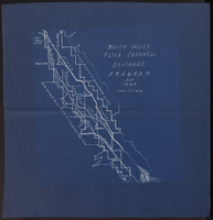
Map of Moapa Valley flood channel drainage program for 1940
Image
View
Blueprint map showing proposed changes to water system, Las Vegas Land & Water Co., Las Vegas, Nevada, circa 1936
Image
View
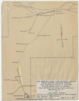
Map showing location of proposed 12-inch water main to connect Well #8 with settling basin serving Reservoir No. 2 at Las Vegas, Nevada, January 16, 1950
Image
View
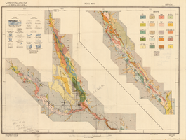
Soil map, Nevada, Moapa Valley sheet, 1923
Image
View
Topographic map of Las Vegas Rancho, showing location of wells and water lines, Las Vegas, Nev., October 18, 1946
Image
View
Map of Las Vegas Valley Water District, December 29, 1952
Image
View
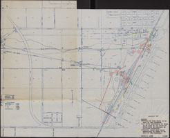
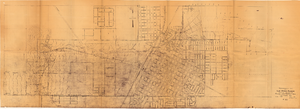
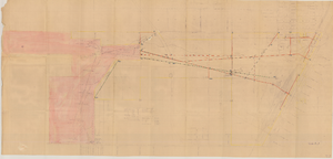
Map showing proposed relocation or removal of existing water transmission mains and power lines at Las Vegas, Nevada, June 3, 1952
Image
View
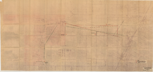
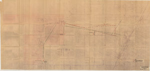
Map showing proposed relocation or removal of existing water transmission mains and power lines at Las Vegas, Nevada, June 3, 1952, copy 1
Image
View
Pagination
First page
« First
Previous page
‹‹
…
Page
2131
Page
2132
Page
2133
Page
2134
Current page
2135
Page
2136
Page
2137
Page
2138
Page
2139
…
Next page
››
Last page
Last »