Skip to main content
Main navigation
Finding Aids
Digital Projects
African American Experience in Las Vegas
Charles Saladino Landscape Architecture Collection
Culinary Union Photograph Collection
Dino at the Sands
Dreaming the Skyline
Entertainment
Historic Landscape of Nevada
Hoover Dam
Jamey Stillings
Menus: The Art of Dining
Nevada Test Site Oral History Project
Newspapers
Oral Histories Collection
Photograph Collections
Rebel Yell Newspaper
Showgirls
Southern Nevada: The Boomtown Years 1900-1925
Southern Nevada History in Maps
Southern Nevada Jewish Heritage Project
UNLV CSUN Records
Union Pacific Railroad Water Documents
Walking Box Ranch Collection
Welcome Home Howard
About
Request Images
Help
Provide Feedback
Special Collections Home
Search the Special Collections and Archives Portal
Search
Search
Breadcrumb
Home
Still Image
A static visual representation
Authority Sources
DCMI Type Vocabulary
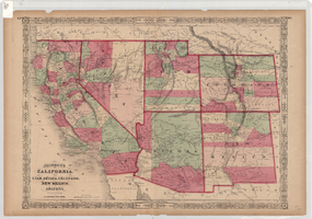
Map of California, Utah, Nevada, Colorado, New Mexico and Arizona, 1864, side 1
Image
View
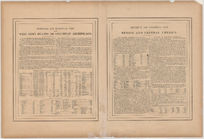
Map of California, Utah, Nevada, Colorado, New Mexico and Arizona, 1864, side 2
Image
View
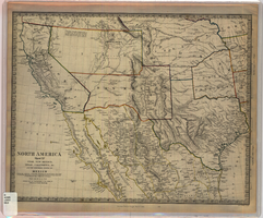
Map of Utah, New Mexico, Texas, California, Indian territory, and the northern states of Mexico, 1852
Image
View
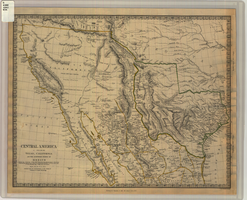
Map of Texas, California, New Mexico and the northern states of Mexico, October 15, 1842
Image
View
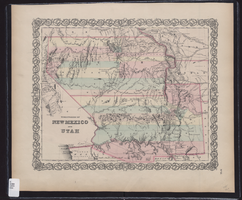
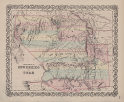
Map showing the territories of New Mexico and Utah, 1855
Image
View
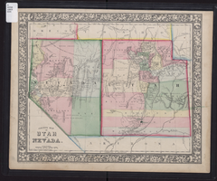
County map of Utah and Nevada, 1865
Image
View
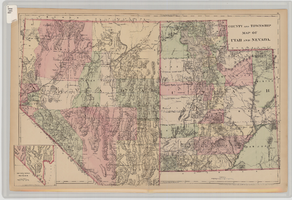
County and township map of Utah and Nevada, 1881
Image
View
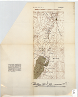
Topographic map of area near Virgin River south of St. Thomas, Nevada, 1936
Image
View
Road map of Hoover Dam and vicinity, circa 1949
Text
View
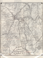
Road map of Hoover Dam and vicinity, circa 1949, side 1
Image
View
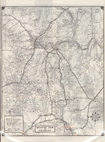
Road map of Hoover Dam and vicinity, circa 1949, side 2
Image
View
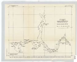
Map of Lake Mead, Arizona-Nevada, showing locations of gages used to establish water-stage elevations during 1947-49 survey
Image
View
Generalized geological map of the Boulder Reservoir floor and adjacent areas, 1936
Image
View
Map of territories of New Mexico and Utah, 1855
Image
View
Map of California, territories of New Mexico, Arizona, Colorado, Nevada and Utah, circa 1863
Image
View
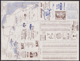
Map of Las Vegas, North Las Vegas, and The Strip, 1956
Text
View
Map of Las Vegas, North Las Vegas, and The Strip, 1956, side 1
Image
View
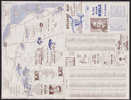
Map of Las Vegas, North Las Vegas, and The Strip, 1956, side 2
Image
View
Pagination
First page
« First
Previous page
‹‹
…
Page
2123
Page
2124
Page
2125
Page
2126
Current page
2127
Page
2128
Page
2129
Page
2130
Page
2131
…
Next page
››
Last page
Last »