Skip to main content
Main navigation
Finding Aids
Digital Projects
African American Experience in Las Vegas
Charles Saladino Landscape Architecture Collection
Culinary Union Photograph Collection
Dino at the Sands
Dreaming the Skyline
Entertainment
Historic Landscape of Nevada
Hoover Dam
Jamey Stillings
Menus: The Art of Dining
Nevada Test Site Oral History Project
Newspapers
Oral Histories Collection
Photograph Collections
Rebel Yell Newspaper
Showgirls
Southern Nevada: The Boomtown Years 1900-1925
Southern Nevada History in Maps
Southern Nevada Jewish Heritage Project
UNLV CSUN Records
Union Pacific Railroad Water Documents
Walking Box Ranch Collection
Welcome Home Howard
About
Request Images
Help
Provide Feedback
Special Collections Home
Search the Special Collections and Archives Portal
Search
Search
Breadcrumb
Home
Still Image
A static visual representation
Authority Sources
DCMI Type Vocabulary
Map of metropolitan Las Vegas, Nevada, 1971
Text
View
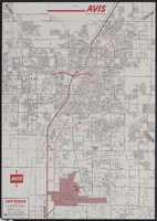
Map of metropolitan Las Vegas, Nevada, 1971, side 1
Image
View
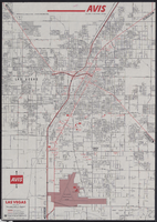
Map of metropolitan Las Vegas, Nevada, 1971, side 2
Image
View
Map of the Las Vegas Strip, downtown Las Vegas and surrounding areas, 1987
Text
View
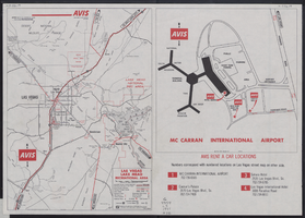
Map of the Las Vegas Strip, downtown Las Vegas and surrounding areas, 1987, side 1
Image
View
Map of the Las Vegas Strip, downtown Las Vegas and surrounding areas, 1987, side 2
Image
View
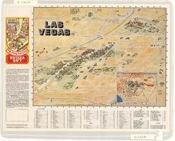
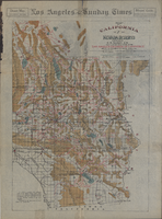
Map of California, with territories of Utah, Nevada, Colorado, New Mexico, and Arizona, 1864
Image
View
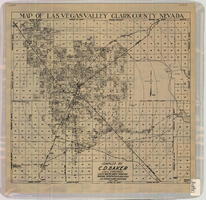
Map of Las Vegas Valley, Clark County, Nevada, October 1, 1940
Image
View
Map of Las Vegas and vicinity, Clark County, Nevada, April 15, 1951
Image
View
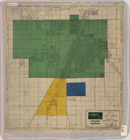
Redevelopment plan map for downtown Las Vegas, Nevada, November 18, 1987
Image
View
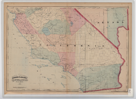
Map of southern California and southern Nevada, 1872
Image
View
Map of California and Nevada deserts, 1905
Image
View
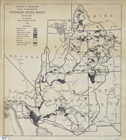
Map of Colorado River Basin, 1928
Image
View
Topographic map of Cane Spring, Nevada quadrangle, 1961
Image
View
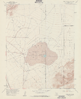
Topographic map of Frenchman Flat quadrangle, Nevada, 1960
Image
View
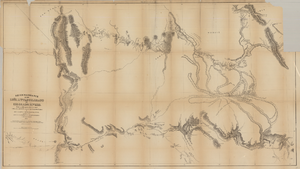
Map based on reconnaissance of the Zuñi, Little Colorado and Colorado Rivers in 1851 by U.S. Corps of Topographical Engineers
Image
View
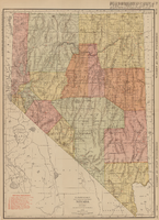
Rand-McNally new commercial atlas map of Nevada, 1912
Image
View
Rand-McNally new commercial atlas map of Nevada, 1912, side 1
Image
View
Pagination
First page
« First
Previous page
‹‹
…
Page
2124
Page
2125
Page
2126
Page
2127
Current page
2128
Page
2129
Page
2130
Page
2131
Page
2132
…
Next page
››
Last page
Last »