Skip to main content
Main navigation
Finding Aids
Digital Projects
African American Experience in Las Vegas
Charles Saladino Landscape Architecture Collection
Culinary Union Photograph Collection
Dino at the Sands
Dreaming the Skyline
Entertainment
Historic Landscape of Nevada
Hoover Dam
Jamey Stillings
Menus: The Art of Dining
Nevada Test Site Oral History Project
Newspapers
Oral Histories Collection
Photograph Collections
Rebel Yell Newspaper
Showgirls
Southern Nevada: The Boomtown Years 1900-1925
Southern Nevada History in Maps
Southern Nevada Jewish Heritage Project
UNLV CSUN Records
Union Pacific Railroad Water Documents
Walking Box Ranch Collection
Welcome Home Howard
About
Request Images
Help
Provide Feedback
Special Collections Home
Search the Special Collections and Archives Portal
Search
Search
Breadcrumb
Home
Still Image
A static visual representation
Authority Sources
DCMI Type Vocabulary
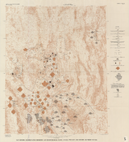
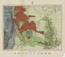
Map showing ground-water chemistry and hydrochemical facies, Nevada Test Site and vicinity, southern Nevada, 1965
Image
View
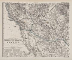
Die Vereinigten Staaten von Amerika in 6 Blättern im Maassstabe von 1:3,700,000
Image
View
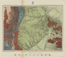
Map of economic features, part of central New Mexico, May 7, 1877
Image
View
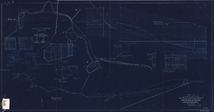
Blueprint showing proposed improvement of Las Vegas Springs, Las Vegas, Nevada, September 21, 1916
Image
View
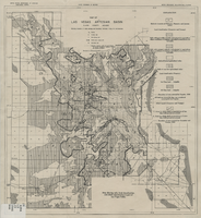
Map of Las Vegas Valley artesian basin, circa 1940
Image
View
Map of parts of southern Colorado and northern New Mexico, atlas sheet no. 70(A), 1877
Image
View
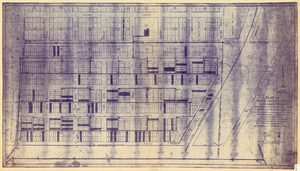
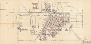
Plat of original townsite of Las Vegas, Clark County, Nevada, November 25, 1927
Image
View
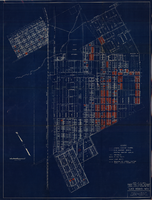
Map showing general plan for the district boundary of Lateral Sanitary Sewer District No. 1, Las Vegas, Nevada, circa 1928
Image
View
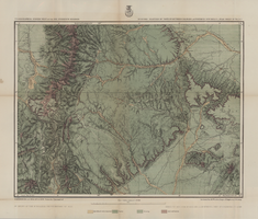
Map of part of North Central New Mexico atlas sheets 69(B), 69(D), 77(B) and 78(A), June 30, 1881
Image
View
Map of Las Vegas artesian basin, Clark County, Nevada, April 1946 (Water Resources Bulletin no. 5, plate 5)
Image
View
Map of part of north central New Mexico, atlas sheet no. 70(C), May 7th, 1877
Image
View
Map of the Great Salt Lake and adjacent country in the territory of Utah, 1850
Image
View
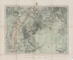
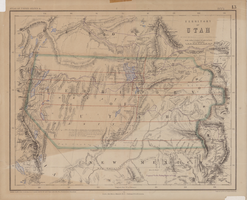
Map of territory of Utah, 1857
Image
View
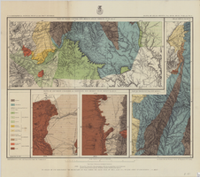
Map of economic features of parts of southern Colorado and northern New Mexico Atlas sheet no. 70(A.), May 5, 1877
Image
View
Maps showing sales of water production facilities of the Union Pacific Railroad Company and water distribution facilities of the Las Vegas Land and Water Co. to the Las Vegas Valley Water District, April 29, 1953
Image
View
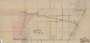
Map showing locations of water bearing lands to be sold to the Las Vegas Valley Water District and boundaries of lands owned by the Union Pacific Railroad not to be sold to the District, April 29,1953
Image
View
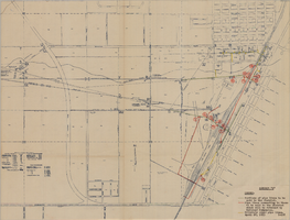
Map showing facilities of the Las Vegas Land and Water Co. completed, under construction and commenced after September 1, 1952
Image
View
Map showing water pipelines to be sold to the Las Vegas Valley Water District, those to be retained by the Union Pacific Railroad Company, and privately owned pipelines, April 29, 1953
Image
View
Pagination
First page
« First
Previous page
‹‹
…
Page
2129
Page
2130
Page
2131
Page
2132
Current page
2133
Page
2134
Page
2135
Page
2136
Page
2137
…
Next page
››
Last page
Last »