Skip to main content
Main navigation
Finding Aids
Digital Projects
African American Experience in Las Vegas
Charles Saladino Landscape Architecture Collection
Culinary Union Photograph Collection
Dino at the Sands
Dreaming the Skyline
Entertainment
Historic Landscape of Nevada
Hoover Dam
Jamey Stillings
Menus: The Art of Dining
Nevada Test Site Oral History Project
Newspapers
Oral Histories Collection
Photograph Collections
Rebel Yell Newspaper
Showgirls
Southern Nevada: The Boomtown Years 1900-1925
Southern Nevada History in Maps
Southern Nevada Jewish Heritage Project
UNLV CSUN Records
Union Pacific Railroad Water Documents
Walking Box Ranch Collection
Welcome Home Howard
About
Request Images
Help
Provide Feedback
Special Collections Home
Search the Special Collections and Archives Portal
Search
Search
Breadcrumb
Home
Still Image
A static visual representation
Authority Sources
DCMI Type Vocabulary
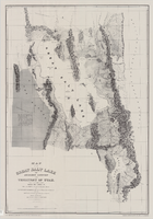
Map of the Great Salt Lake and adjacent country in the territory of Utah, 1852
Image
View
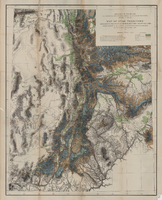
Map of Utah territory representing the extent of the irrigable, timber and pasture lands, 1878
Image
View
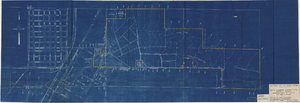
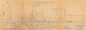
Map showing plan for water quality management update for wastewater collection systems in the Las Vegas Valley, February 20, 1997
Image
View
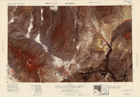
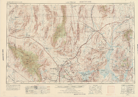
Satellite image map of the Las Vegas Valley, 1981
Image
View
Satellite image map of the Las Vegas Valley, 1981, side 1
Image
View
Satellite image map of the Las Vegas Valley, 1981, side 2
Image
View
Map showing U.S. Bureau of Reclamation Region 3 projects in Arizona, California, Nevada, New Mexico and Utah, September 1967
Image
View
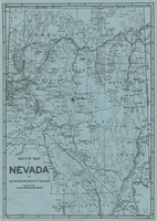
Sketch map of Nevada and the southeastern portion of California, 1906
Image
View
Topographic map of Las Vegas Rancho, showing location of wells and water lines, Las Vegas, Nev., May 1, 1940
Image
View
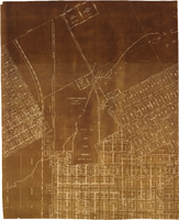
Map of major subdivisions near downtown Las Vegas, Nevada, circa 1931
Image
View
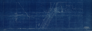
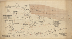
Topographic map showing proposed reservoir for the Las Vegas Rancho, August 4, 1931
Image
View
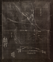
Map showing proposed improvements of Las Vegas Springs, Las Vegas, Nevada, January 26, 1918
Image
View
Map to accompany agreement with Willie T. Stewart covering lease of land at Las Vegas, Nevada, August 10, 1943
Image
View
Map showing property to be leased to Willie T. Stewart, Vernon E. Bunker, Earl Leavitt and William Udell Stewart at Las Vegas, Nevada, January 31, 1951
Image
View
Map to accompany agreement with Willie T. Stewart, Vernon E. Bunker, Earl Leavitt and William Udell Stewart covering lease of Las Vegas Ranch property at Las Vegas, Nevada, January 31, 1951
Image
View
Map showing location of leased properties proposed to be sold to the Las Vegas Land and Water Company, October 2, 1952
Image
View
Blueprint map showing proposed new 12" well and pipe line changes at water springs, Las Vegas, Nevada, circa 1920
Image
View
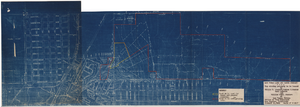
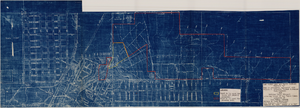
Map showing profile of 24-inch cast iron water pipeline for Las Vegas, Nevada, May 20, 1930
Image
View
Pagination
First page
« First
Previous page
‹‹
…
Page
2130
Page
2131
Page
2132
Page
2133
Current page
2134
Page
2135
Page
2136
Page
2137
Page
2138
…
Next page
››
Last page
Last »