Search the Special Collections and Archives Portal

Search Results
Display    Results Per Page
Displaying results 341 - 350 of 594

Correspondence, Page, McCutchen, Harding and Knight, Attorneys, to H.E. George

Date

1902-01-13

Archival Collection

Description

This folder is from the "Correspondence" file of the Sadie and Hampton George Papers (MS-00434)

Text

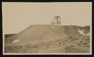
Unidentified mining location, image 001: photographic print

Date

1907 (year approximate) to 1908 (year approximate)

Description

An unidentified mining location, in or near Goldfield, Nevada. Possibly part of the Mohawk Lodge Mine.

Image

Sadie and Hampton George Papers

Identifier

MS-00434

Abstract

The Sadie and Hampton George Papers (1874-1948) consist primarily of the incoming and outgoing correspondence of Sadie Kiel George and her husband, Hampton George, regarding proposed land and mineral rights sales. The collection also includes some personal correspondence, and two of the most significant letters in the collection deal with the deaths of brothers William and Edward Kiel, Sadie's uncles, who were found dead at the Kiel Ranch in October 1900. Also included in the collection are receipts, cancelled checks, tax notices, mining claims, and land deeds.

Archival Collection
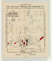
Map of the Bullfrog Mining District, Nye County (Nev.), 1905

Date

1905

Description

Scale [ca. 1:39,000. 1 in. to approx. 3,250 feet] ; 1 map : col. ; 45 x 38 cm ; Relief shown by hachures ; "Compliments of the Forward Mining Development Co." ; Properties owned by Patrick Investment Company are marked in red ; Shows railroads, roads, and pipelines ;

Image

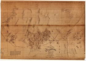
New official map of the Bullfrog Mining District, Nye County (Nev.), 1905

Date

1905

Description

Scale [ca. 1:16,800. 1 inch to approximately 1,400 feet] ; 1 map ; 74 x 109 cm ; Blueline print ; Scale almost illegible ; "Photo. lith. Britton & Rey." ; Photocopy? [United States : s.n., 199-?] ;

Image

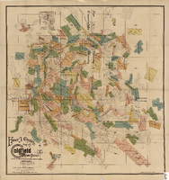
Elmer J. Chute's Map of Goldfield Mining District, Esmeralda and Nye Counties (Nev.), 1905

Date

1905

Description

Scale [ca. 1:20, 400. 1 in.=aprrox. 1,700 feet] ; 1 map : col. ; 60 x 58 cm ; Includes inset location map ; Includes township and range grid ;

Image

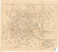
Elmer J. Chute's Diamond Map of the Goldfield Mining District, Esmeralda and Nye Counties (Nev.), 1907

Date

1907

Description

Elmer J. Chute's Diamond Map of the Goldfield Mining District, Esmeralda and Nye Counties (Nev.), 1907

Image

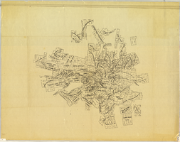
Map of the Tonopah Mining District, Nye County (Nev.), 1905

Date

1905

Description

Scale [ca.1:12,804. 1 in. to approx. 1,067 ft.] ; 1 map ; on sheet 92 x 106 cm ; Relief shown by hachures ; Title supplied by cataloger ; Probably a preliminary black and white edition of the colored map copyrighted by Bradford and Bradford in 1905

Image

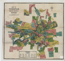
Map of the Tonopah Mining District, Nye County (Nev.), 1905

Date

1905

Description

Scale [ca. 1:15,600. 1 in. to approx. 1300 feet] ; 1 map : col. ; 60 x 64 cm ; Relief shown by hachures ; Copyright held by Bradford & Bradford ; Includes table of distances ; Library's copy has one section outlined in red pencil and Tonopah Victor printed on it in red pencil. Red pencil dots are on two other sections. 1905 printed in pencil and some unreadable words written in pencil near title of map ;

Image

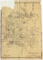
Map of approved mineral surveys in the Goldfield Mining District, Goldfield (Nev.), 1908

Date

1908

Description

Scale [ca. 1:9,600]. 1 in. to 800 feet. (W 117 14'--W 117 09'/N 37 46'--N 37 41') ; 1 map ; 129 x 97 cm ; Blueline print ; Includes township and range grid ; "Copyright 1908 by Davis and Byler. 1911." ; Library's copy has upper-left corner torn off and has circles drawn around and diagonal lines drawn on certain claims ;

Image