Skip to main content
Main navigation
Finding Aids
Digital Projects
African American Experience in Las Vegas
Charles Saladino Landscape Architecture Collection
Culinary Union Photograph Collection
Dino at the Sands
Dreaming the Skyline
Entertainment
Historic Landscape of Nevada
Hoover Dam
Jamey Stillings
Menus: The Art of Dining
Nevada Test Site Oral History Project
Newspapers
Oral Histories Collection
Photograph Collections
Rebel Yell Newspaper
Showgirls
Southern Nevada: The Boomtown Years 1900-1925
Southern Nevada History in Maps
Southern Nevada Jewish Heritage Project
UNLV CSUN Records
Union Pacific Railroad Water Documents
Walking Box Ranch Collection
Welcome Home Howard
About
Request Images
Help
Provide Feedback
Special Collections Home
Search the Special Collections and Archives Portal
Search
Search
Breadcrumb
Home
Still Image
A static visual representation
Authority Sources
DCMI Type Vocabulary
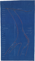
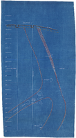
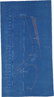
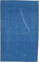
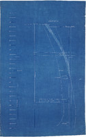
Cross-section maps of Combination and Florence Mines, Goldfield, Nevada, circa 1902-1908, section H
Image
View
Cross-section maps of Combination and Florence Mines, Goldfield, Nevada, circa 1902-1908, section I
Image
View
Cross-section maps of Combination and Florence Mines, Goldfield, Nevada, circa 1902-1908, section J
Image
View
Cross-section maps of Combination and Florence Mines, Goldfield, Nevada, circa 1902-1908, section K
Image
View
Cross-section maps of Combination and Florence Mines, Goldfield, Nevada, circa 1902-1908, section L
Image
View
Geologic map and sections of area along Colorado River between Lake Mead and Davis Dam, Arizona and Nevada, 1963
Image
View
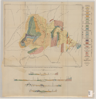
Geologic map and sections of Muddy Mountains, St. Thomas Gap, and part of the Grand Wash Cliffs, 1928
Image
View
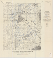
Map of the Las Vegas ground-water basin, Clark, Nye, and Lincoln Counties, Nevada, 1965
Image
View
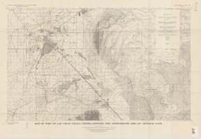
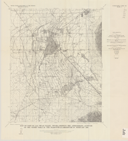
Map of part of Las Vegas Valley, Nevada, showing the approximate area of artesian flow, 1965
Image
View
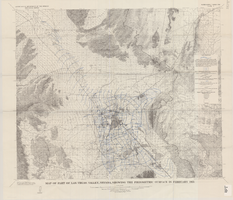
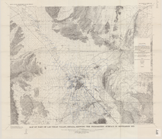
Map of part of Las Vegas Valley, Nevada, showing the piezometric surface in February 1955
Image
View
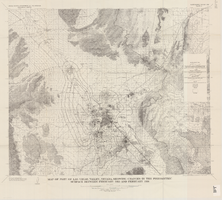
Map of part of Las Vegas Valley, Nevada, showing the piezometric surface in September 1955
Image
View
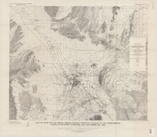
Map of part of Las Vegas Valley, Nevada, showing changes in the piezometric surface between February 1955 and February 1956
Image
View
Map of part of Las Vegas Valley, Nevada, showing changes in the piezometric surface between February 1944 and February 1956
Image
View
Map of part of Las Vegas Valley, Nevada, showing the approximate piezometric surface in 1912
Image
View
Map of part of Las Vegas Valley, Nevada, showing the approximate altitude of the water table in the near-surface reservoir in February 1956
Image
View
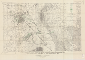
Map of part of Las Vegas Valley, Nevada, showing types, distribution, and approximate areal densities of phreatophytes in 1955
Image
View
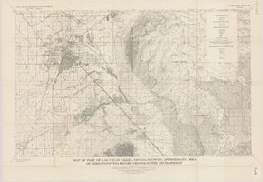
Map of part of Las Vegas Valley, Nevada, showing approximate area of phreatophytes before ground-water development
Image
View
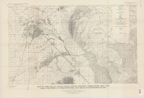
Map of part of Las Vegas Valley, Nevada, showing approximate area and areal densities of phreatophytes and areas in cultivation in 1912
Image
View
Pagination
First page
« First
Previous page
‹‹
…
Page
2139
Page
2140
Page
2141
Page
2142
Current page
2143
Page
2144
Page
2145
Page
2146
Page
2147
…
Next page
››
Last page
Last »