Skip to main content
Main navigation
Finding Aids
Digital Projects
African American Experience in Las Vegas
Charles Saladino Landscape Architecture Collection
Culinary Union Photograph Collection
Dino at the Sands
Dreaming the Skyline
Entertainment
Historic Landscape of Nevada
Hoover Dam
Jamey Stillings
Menus: The Art of Dining
Nevada Test Site Oral History Project
Newspapers
Oral Histories Collection
Photograph Collections
Rebel Yell Newspaper
Showgirls
Southern Nevada: The Boomtown Years 1900-1925
Southern Nevada History in Maps
Southern Nevada Jewish Heritage Project
UNLV CSUN Records
Union Pacific Railroad Water Documents
Walking Box Ranch Collection
Welcome Home Howard
About
Request Images
Help
Provide Feedback
Special Collections Home
Search the Special Collections and Archives Portal
Search
Search
Breadcrumb
Home
Still Image
A static visual representation
Authority Sources
DCMI Type Vocabulary
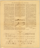
Map of Kawich Quadrangle, Nye County, Nevada, June 1908, side 2
Image
View
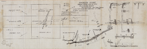
Fairday Mine property map, May 25, 1916
Image
View
Longitudinal section map, Montana Tonopah Mine, circa 1900s-1910s
Image
View
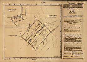
Plat of the claim of George Wingfield, June, 1907
Text
View
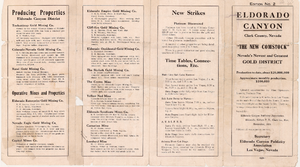
Map of a portion of the Eldorado Mining District, November 1916
Text
View
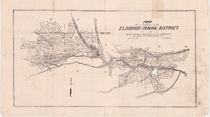
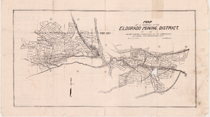
Map of a portion of the Eldorado Mining District, November 1916, side 1
Image
View
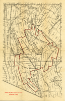
Map of a portion of the Eldorado Mining District, November 1916, side 2
Image
View
Map of mines owned and operated by Goldfield Deep Mines Company of Nevada, circa 1904-1908
Image
View
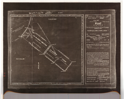
Plat of the Texas and Lone Star Lodes, May, 1905
Text
View
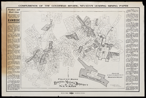
Map of Rawhide Mining District, Nevada, circa 1908
Text
View
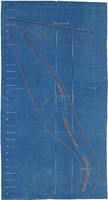
Cross-section maps of Combination and Florence Mines, Goldfield, Nevada, circa 1902-1908
Image
View
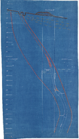
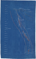
Cross-section maps of Combination and Florence Mines, Goldfield, Nevada, circa 1902-1908, section A
Image
View
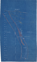
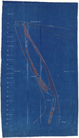
Cross-section maps of Combination and Florence Mines, Goldfield, Nevada, circa 1902-1908, section B
Image
View
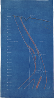
Cross-section maps of Combination and Florence Mines, Goldfield, Nevada, circa 1902-1908, section C
Image
View
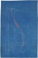
Cross-section maps of Combination and Florence Mines, Goldfield, Nevada, circa 1902-1908, section D
Image
View
Cross-section maps of Combination and Florence Mines, Goldfield, Nevada, circa 1902-1908, section E
Image
View
Cross-section maps of Combination and Florence Mines, Goldfield, Nevada, circa 1902-1908, section F
Image
View
Cross-section maps of Combination and Florence Mines, Goldfield, Nevada, circa 1902-1908, section G
Image
View
Pagination
First page
« First
Previous page
‹‹
…
Page
2138
Page
2139
Page
2140
Page
2141
Current page
2142
Page
2143
Page
2144
Page
2145
Page
2146
…
Next page
››
Last page
Last »