Search Results
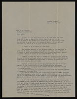
Correspondence, Levi Syphus to Sadie George Clayton
Date
Archival Collection
Description
Text
University of Nevada, Las Vegas Department of Anthropology and Ethnic Studies Records
Identifier
Abstract
The collection is comprised of the University of Nevada, Las Vegas (UNLV) Department of Anthropology and Ethnic Studies administrative records, memoranda, and correspondence dating from 1966 to 2006. The collection includes information about UNLV's department of Anthropology and Ethnic Studies from its inception at Nevada Southern University, its transition to UNLV, and research initiatives the department has undertaken.
Archival Collection
Photo Album
Date
Archival Collection
Description
Mixed Content
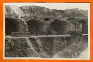
Building or mine remains in Europe: photographic print
Date
Archival Collection
Description
Bell Family Scrapbook scanning, Set 4, proofed 11.04.2010 Building or mine remains in Europe
Image
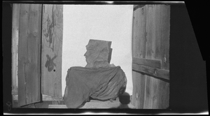
Mine entrance with rock face, image 001 of 002: photographic film
Date
Archival Collection
Description
Image
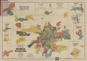
Map of Tonopah Mining District, Nevada, revised edition, 1903
Date
Description
Image
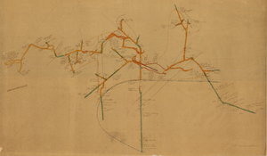
Map of the 450 foot level of the Mohawk Mine, Goldfield, Nevada, circa 1902-1908
Date
Description
Image
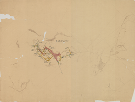
Map of the 280 foot level of the Combination Mine, Goldfield, Nevada, circa 1902-1908
Date
Description
Image
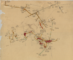
Map of the 600 foot, or third, level of the Clermont Mine, Goldfield, Nevada, circa 1902-1908
Date
Description
Image

Correspondence, Thomas Toland to Levi Syphus
Date
Archival Collection
Description
Text