Search Results
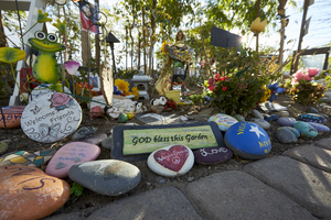
Hand painted stones and decorations at the Las Vegas Community Healing Garden, looking east in Las Vegas, Nevada: digital photograph
Date
Archival Collection
Description
Following the October 1, 2017 killing of 58 people at the Route 91 Harvest Music Festival on the Las Vegas Strip, the Las Vegas community responded in a variety of ways. Envisioned by activists and built by volunteers, the City of Las Vegas established the Las Vegas Community Healing Garden at 1015 S. Casino Center Boulevard to honor the victims and give family members and the community a place to gather to remember.
Image
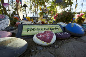
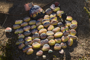
Hand painted stones at the Las Vegas Community Healing Garden, looking east-southeast in Las Vegas, Nevada: digital photograph
Date
Archival Collection
Description
Following the October 1, 2017 killing of 58 people at the Route 91 Harvest Music Festival on the Las Vegas Strip, the Las Vegas community responded in a variety of ways. Envisioned by activists and built by volunteers, the City of Las Vegas established the Las Vegas Community Healing Garden at 1015 S. Casino Center Boulevard to honor the victims and give family members and the community a place to gather to remember.
Image
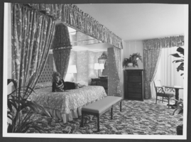
Photograph of a guest room in the Las Vegas Hilton, Las Vegas, Nevada, circa 1974-1975
Date
Archival Collection
Description
Image
The Wheel Las Vegas Rotary Club newsletter, March 10, 1977
Date
Archival Collection
Description
Text
Las Vegas Sun Photographs
Identifier
Abstract
The Las Vegas Sun Photographs depict significant events in Las Vegas, Nevada from 1948 to 1989 that were covered by the newspaper. The photographs partially document the gubernatorial, senatorial, mid-term, and local elections in Nevada in 1982. The photographs also include protests by African Americans for better wages and renters for fair housing practices, McCarran Airport, protests against the Nevada Test Site, the Las Vegas Strip and downtown Las Vegas, hotels and casinos, political events, parades, dedications of buildings, and aerial photographs of the city. The photographs also depict politicians during campaign events and fundraisers, including President Ronald Reagan; U.S. Senators Howard Cannon, Pat McCarran, Chic Hecht, Paul Laxalt, and Harry Reid; Nevada governors Mike O'Callaghan and Robert List; and Lieutenant Governor Bob Cashell.
Archival Collection
The Wheel Las Vegas Rotary Club newsletter, March 17, 1983
Date
Archival Collection
Description
Text
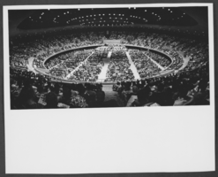
Photograph of Las Vegas Convention Center interior, Las Vegas, 1966
Date
Archival Collection
Description
Image
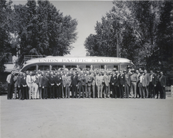
Photograph of the Las Vegas Rotary Club, Las Vegas, 1940
Date
Archival Collection
Description
A black and white image of Las Vegas Rotary Club members in front of a Union Pacific Stages bus in Las Vegas. This photo was taken from a time capsule in the cornerstone of the Union Pacific Railroad station located in Las Vegas. The time capsule was placed there in 1940 and was later retrieved when the building was demolished around 1970.
Image
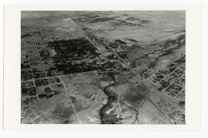
Aerial photograph of McWilliams' Original Las Vegas Townsite and Clark's Las Vegas Townsite, Las Vegas (Nev.), 1931
Date
Archival Collection
Description
Image