Search Results
Jewish Federation correspondence, meeting minutes, and other records, item 18
Description
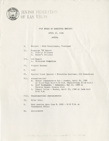
Jewish Federation of Las Vegas (JFLV) Board of Directors Meeting minutes, April 20, 1988.

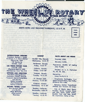
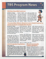
The Wheel of Rotary Las Vegas Rotary Club newsletter, January 6, 1955
Date
1955-01-06
Archival Collection
Description
Official publication of Las Vegas, Nevada Rotary Club
Text
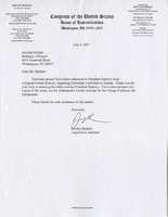
Alpha Kappa Alpha Sorority, Theta Theta Omega Chapter graduate advisor's reports
Date
1997-02-01
1997-05
1997-06-07
1997-09-12
1997-10-04
1997-11-01
Archival Collection
Description
From the Alpha Kappa Alpha Sorority, Incorporated, Theta Theta Omega Chapter Records (MS-01014) -- Chapter records file.
Text