Search the Special Collections and Archives Portal
Search Results

Hotel Nevada and Nevada Club wall and roof mounted signs, Ely, Nevada
Date
Archival Collection
Description
View of the signs for the Hotel Nevada and Nevada Club, including a closeup of a slot machine sign.
501 E Aultman St, Ely, NV 89301
Image
Nevada Women's Archives Records
Identifier
Abstract
Records (1994-1999) are comprised of planning documents, newspaper clippings, external communication, and memoranda documenting the establishment and operations of the Nevada Women's Archives at the University of Nevada, Las Vegas. The records primarily document collection materials from the first exhibit created using the Nevada Women's Archive.
Archival Collection

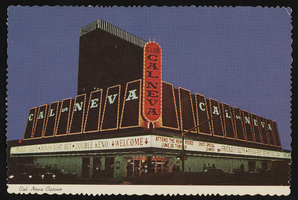
Club Cal Nevada in Reno, Nevada: postcard
Date
Archival Collection
Description
Image

Club Cal Nevada in Reno, Nevada: postcard
Date
Archival Collection
Description
Image
Hotel Nevada Guest Register
Identifier
Abstract
The Hotel Nevada Guest Register (1910-1911) consists of one register from the Hotel Nevada, which opened on the southeast corner of Main Street and Fremont Street in Las Vegas, Nevada in 1906. This particular volume lists guest names and their home citieslocated on the corner of Fremont and Main Streets.
Archival Collection
Nevada State Highway Commission Reports
Identifier
Abstract
The Nevada State Highway Commission Reports (1917-1972) contain biennial reports regarding completed and planned projects of the Nevada Department of Highways.
Archival Collection

Hydrogeologic map of Nevada Test Site and vicinity, southern Nevada, 1965
Date
Description
Image
Nevada Resort Association Records
Identifier
Abstract
The records are comprised of subject files and reports from approximately the 1990s to the 2000s related to data gathering and lobbying activities of the Nevada Resort Association. Materials include drafts of legislation related to gaming, tax reports, health and safety regulations, labor and employment matters, and zoning issues.
Archival Collection

Photograph of Nevada governors, Nevada, 1973
Date
Archival Collection
Description
Image

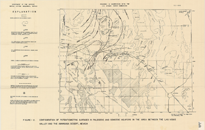
Map showing configuration of potentiometric surfaces in Paleozoic and Cenozoic aquifers in the area between the Las Vegas Valley and the Amargosa Desert, Nevada, 1963
Date
Description
Image
