Skip to main content
Main navigation
Finding Aids
Digital Projects
African American Experience in Las Vegas
Charles Saladino Landscape Architecture Collection
Culinary Union Photograph Collection
Dino at the Sands
Dreaming the Skyline
Entertainment
Historic Landscape of Nevada
Hoover Dam
Jamey Stillings
Menus: The Art of Dining
Nevada Test Site Oral History Project
Newspapers
Oral Histories Collection
Photograph Collections
Rebel Yell Newspaper
Showgirls
Southern Nevada: The Boomtown Years 1900-1925
Southern Nevada History in Maps
Southern Nevada Jewish Heritage Project
UNLV CSUN Records
Union Pacific Railroad Water Documents
Walking Box Ranch Collection
Welcome Home Howard
About
Request Images
Help
Provide Feedback
Special Collections Home
Search the Special Collections and Archives Portal
Search
Search
Breadcrumb
Special Collections and Archives Portal
North America--Colorado River Region
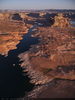
Aerial photograph of Lake Powell's Antelope Point Marina in Arizona: digital photograph
Image
View
Aerial photograph of Lake Powell's Antelope Point Marina in Arizona: digital photograph
Image
View
Aerial photograph of a canyon wall at Lake Powell's Antelope Point Marina in Arizona: digital photograph
Image
View
Aerial photograph of a canyon wall near Lake Powell's Antelope Point in Arizona: digital photograph
Image
View
Aerial photograph looking southeast from above Lake Powell's Gunsight Bay at sunrise in Utah: digital photograph
Image
View
Aerial photograph looking northwest at Lake Powell's Gunsight Bay at sunrise in Utah: digital photograph
Image
View
Aerial photograph looking south at Lake Powell's Crossing of the Fathers area at sunrise in Utah: digital photograph
Image
View
Aerial photograph looking south at Lake Powell's Gregory Butte at sunrise in Utah: digital photograph
Image
View
Aerial photograph looking west-northwest towards Lake Powell's Kane Point from near Gregory Butte in Utah: digital photograph
Image
View
Aerial photograph from above Lake Powell's Kane Point looking south towards Face Canyon at sunrise: digital photograph
Image
View
Aerial photograph from above Lake Powell looking southeast, near Kane Point in Utah: digital photograph
Image
View
Aerial photograph from above Lake Powell looking south, towards Dungeon Canyon in Utah: digital photograph
Image
View
Aerial photograph of Lake Powell's Reflection Canyon, looking south in Utah: digital photograph
Image
View
Aerial photograph of Lake Powell's Hole-in-the-Rock area, looking north in Utah: digital photograph
Image
View
Aerial photograph of Lake Powell's Reflection Canyon, looking southeast in Utah: digital photograph
Image
View
Aerial photograph of the Escalante River and Fiftymile Creek area of Lake Powell in Utah: digital photograph
Image
View
Aerial photograph of the Escalante River and Indian Creek area of Lake Powell in Utah: digital photograph
Image
View
Aerial photograph of cliff walls and water south of Halls Crossing on Lake Powell in Utah: digital photograph
Image
View
Pagination
First page
« First
Previous page
‹‹
Page
1
Page
2
Current page
3
Page
4
Page
5
Page
6
Page
7
Page
8
Page
9
…
Next page
››
Last page
Last »