Skip to main content
Main navigation
Finding Aids
Digital Projects
African American Experience in Las Vegas
Charles Saladino Landscape Architecture Collection
Culinary Union Photograph Collection
Dino at the Sands
Dreaming the Skyline
Entertainment
Historic Landscape of Nevada
Hoover Dam
Jamey Stillings
Menus: The Art of Dining
Nevada Test Site Oral History Project
Newspapers
Oral Histories Collection
Photograph Collections
Rebel Yell Newspaper
Showgirls
Southern Nevada: The Boomtown Years 1900-1925
Southern Nevada History in Maps
Southern Nevada Jewish Heritage Project
UNLV CSUN Records
Union Pacific Railroad Water Documents
Walking Box Ranch Collection
Welcome Home Howard
About
Request Images
Help
Provide Feedback
Special Collections Home
Search the Special Collections and Archives Portal
Search
Search
Breadcrumb
Special Collections and Archives Portal
Nevada
Authority Link
GeoNames
Broader
United States
Feature
first-order administrative division
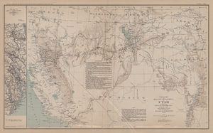
Map showing parts of eastern and southeastern Nevada and southwestern Utah, circa 1873
Image
View
Original plat, townsite of Las Vegas, Lincoln Co., Nevada, January 13, 1905
Image
View
Topographic map of Nevada-California, Las Vegas quadrangle, 1951
Image
View
Topographic map of Nevada-California, Las Vegas quadrangle, March 1908
Text
View
Map of Nevada, circa 1909
Mixed Content
View
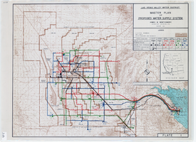
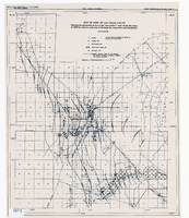
Topographic map of master plan for proposed water supply system for Las Vegas Valley Water District, August 1960
Image
View
Map of the city of Las Vegas, Nevada, June 1, 1946
Image
View
Map of the territories of New Mexico, Arizona, Colorado, Nevada, and Utah, 1855
Image
View
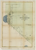
Map showing detailed topography of the country traversed by the reconnaissance expedition through southern & southeastern Nevada, 1869 (reproduction)
Image
View
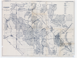
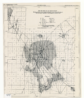
Map showing areas of bedrock and valley fill, drainage boundary, areas of artesian flow, and precipitation stations in the Las Vegas Valley area, 1946
Image
View
Map of California and territories of New Mexico and Utah, circa 1861
Image
View
Map of territory and military department of Utah, 1860
Image
View
Map of the state of Nevada to accompany the annual report of the Commr. Genl. Land Office, October 2, 1866
Image
View
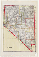
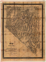
Map of the state of Nevada, 1886
Image
View
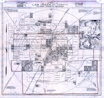
Map of the city of Las Vegas and vicinity, Clark County, Nevada, 1929
Image
View
Map of public surveys in Nevada Territory to accompany report of Surveyor General, October 1, 1862
Image
View
Map of part of Las Vegas Valley showing the piezometric surface of the "near-surface" water during the spring of 1946 by contours, and areas of discharge by evaporation and transpiration
Image
View
Map of part of Las Vegas Valley showing contours of the composite piezometric surface during the spring of 1944, and specific capacities of wells tapping the confined water
Image
View
Pagination
First page
« First
Previous page
‹‹
…
Page
66
Page
67
Page
68
Page
69
Current page
70
Page
71
Page
72
Page
73
Page
74
Next page
››
Last page
Last »