Search the Special Collections and Archives Portal
Search Results

Photograph of brick dwellings, Valley of Fire (Nev.), January 1934
Date
1934-01
Archival Collection
Description
Nevada-Valley of Fire. Petroglyphs, Valley of Fire. 1/34 (neg. only) Duplicate image in photo sleeve.
Image
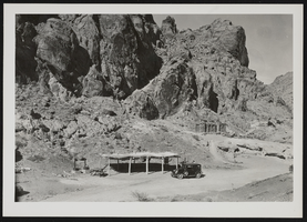
Photograph of stone camping cabins, Valley of Fire (Nev.), 1934
Date
1934
Archival Collection
Description
Stone camping cabins for use of the public at Valley of Fire. "1934, Shellbach photo."
Image
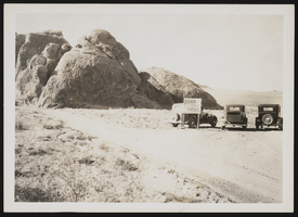
Photograph of parked automobiles, Valley of Fire (Nev.), 1934
Date
1934
Archival Collection
Description
General view of public campgrounds in Valley of Fire, Boulder Dam State Park project (ECW) Overton, NV. Sign next to automobiles reads "Park Cars Here."
Image
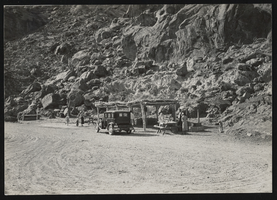
Photograph of rock formation, Valley of Fire (Nev.), January 1934
Date
1934-01
Archival Collection
Description
Unidentified individuals stand near a wooden dwelling campsite area near a large, rocky mountain. Inscription reads: "Nevada-Valley of Fire. Atlatl Rock, Overton, NV. Project report, 1934 Shellbach photo."
Image
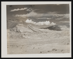
Photograph of mountain landscape, (Nev.), October 6, 1935
Date
1936-10-06
Archival Collection
Description
Mountainous landscape stretches across the desert with white clouds floating overhead. Inscription reads: "Nevada-Lyons, Co. Ft. Churchill. Subsistence warehouse at Ft. Churchill, clear. 10/6/36."
Image
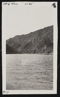
Photograph of Iceberg Canyon, Colorado River, November 1935
Date
1935-11
Archival Collection
Description
Traveling along the Colorado River, "Iceberg Canyon" is up ahead looking east.
Image
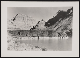
Photograph of cliffs and riverbanks, Colorado River, January 1936
Date
1936-01
Archival Collection
Description
Colorado River cliffs from 5 miles above Pearce Ferry.
Image

Photograph of man sitting on rock, Colorado River, November 1937
Date
1937-11
Archival Collection
Description
Unidentified man sits on a rock on the "Arizona" side of the Colorado River. Inscription with image reads: "Cross section of a lava flow jilting a former channel of the Colorado River in Lower Grand Canyon, approximately 19 miles east of Pierce's [Pearce] Ferry. Under our geological program, studies of this flow are being made before the rising of Lake Mead obliterated portions of it from view."
Image

Photograph of Surprise Creek, Colorado River, November 1937
Date
1937-11
Archival Collection
Description
View of lower canyon at Surprise Creek near the present head of Lake Mead along the Coloardo River, about 28 miles east of Pearce Ferry.
Image
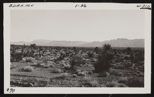
Photograph of desert landscape near Pearce Ferry, (Ariz.), October 1935
Date
1935-10
Archival Collection
Description
Arizona-Colorado River Landscapes. Looking downstream towards first canyon below Pierce's Ferry.
Image
Pagination
Refine my results
Content Type
Creator or Contributor
Subject
Archival Collection
Digital Project
Resource Type
Year
Material Type
Place
Language
Records Classification
