Search the Special Collections and Archives Portal

Search Results
Display    Results Per Page
Displaying results 15001 - 15010 of 15952

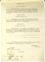
Meeting minutes for Consolidated Student Senate, University of Nevada, Las Vegas, February 23, 1983

Date

1983-02-23

Description

Includes meeting agenda and minutes along with additional information about nominations for outstanding teacher award. CSUN Session 13 (Part 1) Meeting Minutes and Agendas.

Text

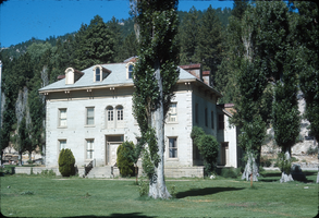
Slide of the Bowers Mansion, Washoe Valley, Nevada, circa 1970s

Date

1970 to 1979

Description

The Bowers Mansion was built in 1863 by Lemuel "Sandy" Bowers and his wife, Eilley Orrum Bowers, and is a prime example of the homes built in Nevada by the new millionaires of the Comstock Lode mining boom. The mansion, designed by J. Neely Johnson, a builder and ex-governor of California, combined Georgian Revival and Italianate architectural styles. It was modeled after a design conceived by Eilley based on her recollection of elegant buildings in her native Scotland. Following the death of Sandy Bowers in 1868, Eilley fell on hard financial times. She generated income by renting out rooms in the mansion and hosting parties and picnics on the grounds. The mansion hosted a ball for the women's suffrage movement and was the location of the annual Miner's Ball. The period of 1873–75 was the height of the mansion's popularity. However, this was not enough to overcome Eilley's debts and she finally lost her home to foreclosure in 1876. The mansion was abandoned by the time Henry Riter acquired it and operated it as a resort until 1946. The building is currently owned and operated by the Washoe County Parks Department. Some 500 Nevada families have donated period furniture housed in the mansion. The park blends the historical site with recreational facilities such as a spring-fed swimming pool, picnic areas, and a playground. The Bowers Mansion is located in Washoe Valley, within the Bowers Mansion Regional Park at 4005 Old U.S. Highway 395 North, North Washoe Valley, Nevada.

Image

Map showing detailed topography of the country traversed by the reconnaissance expedition through southern & southeastern Nevada, 1869 (reproduction)

Date

1869

Description

At top of map: 'Reconnaissance Maps, Department of California.' 'In charge of, Lieut. Geo. M. Wheeler, U.S. Engineers; assisted by Lieut. D.W. Lockwood, Corps of Engineers,U.S.A., 1969.' 'P.W. Hamel, chief topographer and draugthsman.' 'Traced 11-13-67.' 'BGS'; the G is enclosed in an arrowhead shape. 'Officially compiled and published at the Engineer Office, Head Quarters Department of California in 1869 and 70 by order of Brigadier General E.O.C. Ord. Comm'dg. [signed] Geo. M. Wheeler, Lieutenant of Engineers In Charge, Head Quarters Dept. of Cal. Oct. 26th, 1870.' Includes information from railroad maps, the United States Geological Survey of the 40th parallel and from Lieutenant Ives' explorations along the Colorado. Map includes camps, astronomical stations, good and bad wagon roads, trails, springs, settlements, mining districts, state and county boundaries and the watershed between the Humboldt and Colorado Basin. Shows most of eastern half of Nevada. Relief shown by hachures and spot heights. Scale indeterminable. (W 117°00´--W 113°00´/N 41°45´--N 35°45´). Series: Reconnaissance maps. Military map / Department of California
no. 1. Reproduction. Map is printed in purple. Scale of original map: [1:760,320]. 1 in. to approx. 12 miles. Includes dots hand-colored with red pencil marking Indian rancherias.

Image

Transcript of interview with Russell Grater by Frederick Dougan, February 10, 1977

Date

1977-02-10

Description

On February 10, 1977, Frederick Dougan interviewed Russell Grater (born 1907 in Lebanon, Indiana) about his career in the U.S. National Park Service. Grater first talks about his move to the Southern Nevada area and his work that impacted the Hoover Dam project. He then talks about the town of St. Thomas, Nevada, the Lost City, and the activities of tourists. Grater also talks about his work in excavation, the indigenous American Indian tribes of the area, findings on petroglyphs, and the types of wildlife that were found in the area. He later talks about findings related to fossils, gold mining, the effects of World War II on the dam project, and vegetation in the area.

Text

Emerson, David

David W. Emerson was born in Littleton, Massachusetts. His father, a mining engineer, moved the family to Mexico twice, once when he was one year old and again when he was seven. In 1938, his father retired to work on his apple orchard in

Littleton. Emerson helped with pruning, spraying and dusting for insects, and hauling apples to the cider mill.

Person

Denton, Hazel Baker, 1887-1962

Hazel Baker Denton (1887-1962) was a prolific writer, educator, active community member, and elected to serve the Nevada State Assembly in the early 1950s.

Person

Wells, Herbert C., 1927-2010

Herbert C. Wells was born April 11, 1927 in Omaha, Nebraska. After his father was killed in a plane crash in 1931, his mother moved herself and Wells to Los Angeles, California to be near her husband's parents. They moved several times, but the goal was always to find good schools for Wells and his sister.

Person
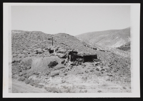
Candelaria Ruins of Mt. Diablo, Nevada: photographic prints

Date

1971-03-09

Description

From the Nan Doughty Photograph Collection (PH-00240). Candelaria Ruins of Mt. Diablo superintendent's house in Pickhandle Gulch, mouth of tunnel, behind fallen roof is where William H. Shockley kept milk and butter cool and stored books and papers during his absence.

Image