Search Results
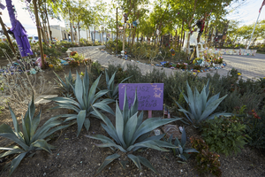
Landscaping at the Las Vegas Community Healing Garden, looking east in Las Vegas, Nevada: digital photograph
Date
Archival Collection
Description
Following the October 1, 2017 killing of 58 people at the Route 91 Harvest Music Festival on the Las Vegas Strip, the Las Vegas community responded in a variety of ways. Envisioned by activists and built by volunteers, the City of Las Vegas established the Las Vegas Community Healing Garden at 1015 S. Casino Center Boulevard to honor the victims and give family members and the community a place to gather to remember.
Image
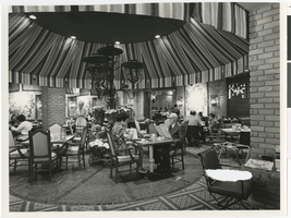
Photograph of the Market Plaza coffee shop, Las Vegas Hilton, Las Vegas, Nevada, circa 1974-1975
Date
Archival Collection
Description
Image
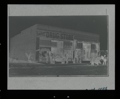
Photograph of the exterior of the Las Vegas Drug Store, Las Vegas (Nev.), 1905-1906
Date
Archival Collection
Description
Image
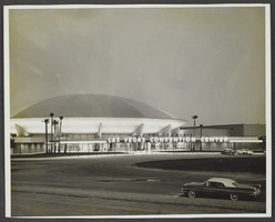
Photograph of Las Vegas Convention Center, Las Vegas, 1966
Date
Archival Collection
Description
Image
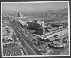
Photograph of hotels on Las Vegas Boulevard, Las Vegas, Nevada, circa 1966
Date
Archival Collection
Description
Image
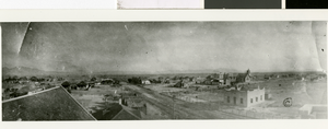
Photograph of early Las Vegas, Las Vegas, 1910
Date
Archival Collection
Description
Image

The Sky Las Vegas Tower, Las Vegas, Nevada: digital photograph
Date
Archival Collection
Description
Image
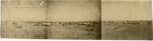
Panoramic view of Clark's Las Vegas Townsite, Las Vegas (Nev.), 1905
Date
Archival Collection
Description
Caption: Los [sic] Vegas Nevada, Aug 1905 from Salt Lake Depot then under construction
Image
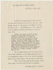
Letter from the Las Vegas Land and Water Company (Las Vegas), March 30, 1940
Date
Archival Collection
Description
Circular letter from the Las Vegas Land and Water Company endorsing City Ordinance No. 247
Text
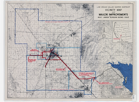
Map showing improvements made to the Las Vegas Valley Water District and vicinity under $8,700,000 bond issue,circa 1957
Date
Description
Image