Search Results
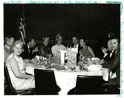
Photograph of the Las Vegas Press Club Installation at the Sands Hotel in Las Vegas, circa April 1969
Date
1969-04
Archival Collection
Description
The black and white view of Jack Fox (United Press International), Mr. and Mrs. Bernie Miller (G.Q.), Mr. and Mrs. Ray Maroney (United Press International), Phil Curran (United Feat Syndicate), and Kevin Thomas (Los Angeles Times) at the Las Vegas Press Club event at the Sands Hotel in Las Vegas, Nevada.
Image
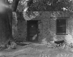
Film transparency of Las Vegas Fort, Las Vegas, 1930
Date
1930
Archival Collection
Description
The Las Vegas Fort being renovated into a concrete/gravel testing laboratory for the Bureau of Reclamation in Las Vegas, Nevada.
Image

Film transparency of Las Vegas Fort, Las Vegas, 1930
Date
1930
Archival Collection
Description
The Las Vegas Fort being renovated into a concrete/gravel testing laboratory for the Bureau of Reclamation in Las Vegas, Nevada.
Image
Las Vegas, Nevada - stockyards
Date
1935
Archival Collection
Description
Series 2. Las Vegas Land and Water Company -- Walter Bracken and the Las Vegas, Nevada Office -- Water Company
Mixed Content
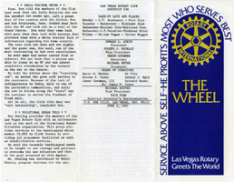
The Wheel Las Vegas Rotary Club newsletter, June 3, 1982
Date
1982-06-03
Archival Collection
Description
Newsletter issued by the Las Vegas Rotary Club
Text
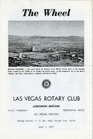
The Wheel Las Vegas Rotary Club newsletter, July 1, 1971
Date
1971-07-01
Archival Collection
Description
Newsletter issued by the Las Vegas Rotary Club
Text
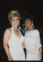
Kenny Kerr, Las Vegas performer, Las Vegas performer in Las Vegas, Nevada: photographic prints
Date
1995
Archival Collection
Description
From the Las Vegas Bugle Photograph Collection on Lesbian, Gay, Bisexual, and Transgender History (PH-00336). Kenny Kerr, Las Vegas performer - 1995.
Image
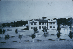
Slide of Las Vegas Grammar School, Las Vegas, 1919
Date
1919
Archival Collection
Description
An exterior view of the Las Vegas Grammar School, also known as the 5th Street School, in Las Vegas, Nevada.
Image
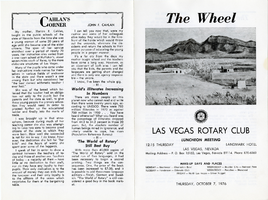
The Wheel Las Vegas Rotary Club newsletter, October 7, 1976
Date
1976-10-07
Archival Collection
Description
Newsletter issued by the Las Vegas Rotary Club
Text
The Wheel Las Vegas Rotary Club newsletter, 1977-1978
Date
1977 to 1978
Archival Collection
Description
Newsletter issued by the Las Vegas Rotary Club
Text