Search Results
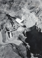
Aerial photograph of Hoover Dam, circa 1930-1949
Date
1930 to 1949
Archival Collection
Description
An aerial view of Hoover Dam.
Image
Aerial photograph of Las Vegas, 1955
Date
1955
Archival Collection
Description
Aerial view of Las Vegas Blvd. and the Union Pacific Railroad tracks looking north over the Dunes Hotel and Flamingo Casino.
Image
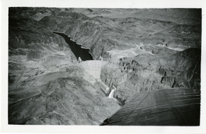
Aerial photograph of Hoover Dam, circa early 1940s
Date
1940 to 1945
Archival Collection
Description
Aerial view of Hoover Dam.
Image
Aerial photograph of Hoover Dam, circa mid to late 1900s
Date
1950 to 1999
Archival Collection
Description
An aerial view of Boulder Dam.
Image
Aerial photograph of Las Vegas, 1920s
Date
1920 (year uncertain)
Archival Collection
Description
Aerial view of Las Vegas looking northwest over the Union Pacific Railroad yards.
Image
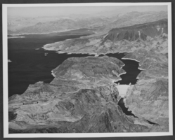
Film transparency of an aerial view of Lake Mead, circa 1930s
Date
1934 to 1939
Archival Collection
Description
Aerial view of the shoreline of Lake Mead.
Image
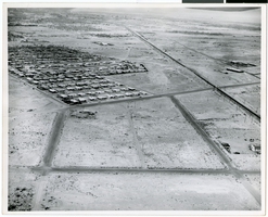
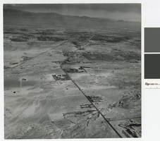
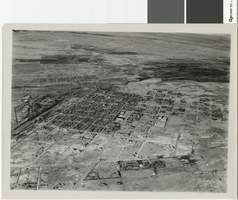
Aerial photograph of North Las Vegas, circa early 1970s
Date
1970 to 1975
Archival Collection
Description
Aerial photograph of the streets and roads of North Las Vegas.
Image
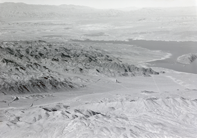
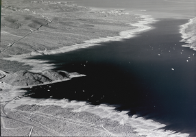
Film transparency of an aerial view of Lake Mead, circa 1930s
Date
1934 to 1939
Archival Collection
Description
Aerial view of Lake Mead and its shoreline.
Image
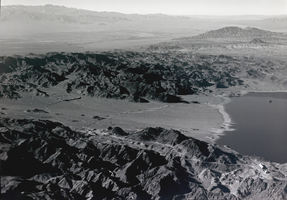
Film transparency of an aerial view of Lake Mead, circa 1930s
Date
1934 to 1939
Archival Collection
Description
Aerial view of Lake Mead and its shoreline.
Image
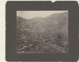
Aerial photograph of Pioche, Nevada, circa 1880s-1890s
Date
1880 to 1899
Archival Collection
Description
An aerial view of Pioche, Nevada. The Dexter Stables, Marysville Hotel, J. J. Halpin &Co. Hardware and another hardware store, furniture stores and a tobacco store are identified.
Image