Search Results
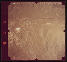
Aerial photograph of a wasteland, Henderson (Nev.), June 5, 1980
Date
Archival Collection
Description
Image
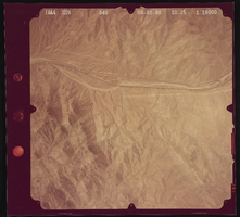
Aerial photograph of the desert, Henderson (Nev.), June 5, 1980
Date
Archival Collection
Description
Image
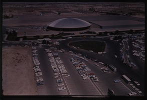
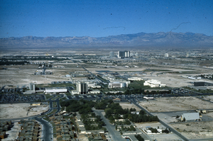
Color aerial view of the Las Vegas Convention Center.
Date
Description
Image
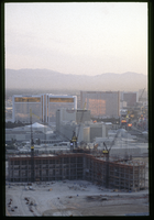
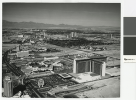
Bellagio resort under construction, Las Vegas, Nevada: aerial photograph
Date
Archival Collection
Description
Photographs from the Greg Cava Photograph Collection -- Chronological shoots -- 1994-1997 -- Job #96-497: Aerial of Bellagio for The Mirage file.
Image
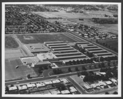
Aerial photograph of Rancho High School, North Las Vegas, Nevada, circa 1960s-1970s
Date
Archival Collection
Description
Image

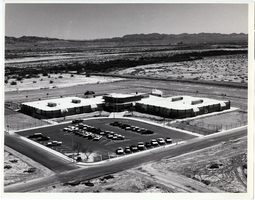
Aerial photograph of C. P. Squires Elementary School, North Las Vegas, Nevada, circa 1960s-1970s
Date
Archival Collection
Description
Image
Slide of aerial view of University of Nevada, Las Vegas campus, circa 1972-1975
Date
Archival Collection
Description
Image
Aerial photograph of the Las Vegas Strip, circa mid 1970s
Date
Archival Collection
Description
Aerial view of the Las Vegas Strip, looking north from the former MGM Grand, since renamed Bally's. Also shown is the former Dunes Hotel, where Bellagio now stands, as well as Caesars Palace, the Flamingo, the Sands, the Frontier, Circus Circus, the Las Vegas Hilton. In the distance is Downtown Las Vegas.
Site Name: Las Vegas Strip
Address: Las Vegas Boulevard, Las Vegas, NV
Image
Aerial photograph of Elbert Edwards Elementary School, Las Vegas, Nevada, circa 1970s-1980s
Date
Archival Collection
Description
Image

Slide of aerial view of University of Nevada, Las Vegas campus, circa 1963-1966
Date
Archival Collection
Description
Image