Search Results
Site Characterization and Validation: Final Report - Stripa Project 92-22, 1992 April
Level of Description
File
Archival Collection
Yucca Mountain Site Characterization Office Collection
To request this item in person:
Collection Number: MS-00091
Collection Name: Yucca Mountain Site Characterization Office Collection
Box/Folder: Box 82
Collection Name: Yucca Mountain Site Characterization Office Collection
Box/Folder: Box 82
Archival Component
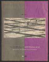
NAMES Project AIDS Memorial Quilt booklet
Date
1990 (year approximate) to 1999 (year approximate)
Archival Collection
Description
From the Dennis McBride Collection on LGBTQ Las Vegas, Nevada (MS-00802) -- Alphabetical research files -- AIDS: Organizations: Names Project [AIDS quilt] file.
Text
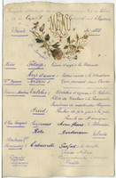
Café de Paris, menu, June 22, 1888
Date
1888-06-22
Archival Collection
Description
Note: Handwritten menu Restaurant: Café de Paris (Buenos Aires, Argentina) Location: Buenos Aires, Argentina
Text

Café de Paris, menu, July 22nd, 1888
Date
1888-07-22
Archival Collection
Description
Restaurant: Café de Paris (Buenos Aires, Argentina) Location: Buenos Aires, Argentina
Text
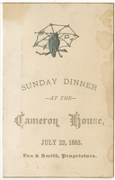
Cameron House, menu, Sunday, July 22, 1883
Date
1883-07-22
Archival Collection
Description
Restaurant: Cameron House Location: La Crosse, Wisconsin, United States
Text
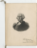
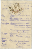
Washington's birthday menu, Sunday, February 22, 1903 at the Chittenden
Date
1903-02-22
Archival Collection
Description
Note: Portrait of George Washington on the cover Menu insert: Music Programs Restaurant: The Chittenden Location: Columbus, Ohio, United States
Text

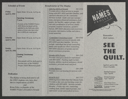
NAMES Project event program
Date
1994-04-08 to 1994-04-10
Archival Collection
Description
From the Dennis McBride Collection on LGBTQ Las Vegas, Nevada (MS-00802) -- Alphabetical research files -- AIDS: Organizations: Names Project [AIDS quilt] file.
Text
Café de Paris, menu, June 22nd, 1888
Date
1888-06-22
Archival Collection
Description
Note: Handwritten menu Restaurant: Café de Paris (Buenos Aires, Argentina) Location: Buenos Aires, Argentina
Text
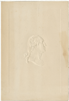
Washington's birthday, Thursday, February 22, 1923, Hotel Vendome
Date
1923-02-22
Archival Collection
Description
Note: Embossed bust of George Washington on the cover Menu insert: Advertisements Restaurant: Vendome Hotel (Reno, Nev.) Location: Boston, Massachusetts, United States
Text