Search Results
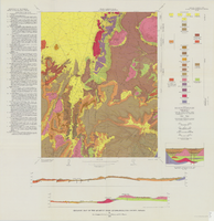
Geologic map of the Quartet Dome quadrangle, Nye County, Nevada, 1966
Date
1966
Description
58 x 46 cm., on sheet 88 x 85 cm., folded in envelope 30 x 24 cm. Relief shown by contours and spot heights. "Contour interval 20 feet." "Base by U.S. Geological Survey, 1962, 10,000-foot grid based on Nevada coordinate system, central zone." "Geology mapped in 1962-63." Includes 2 col. cross sections, diagrammetric stratigraphic section, quadrangle location map, and text. "Prepared in cooperation with the U.S. Atomic Energy Commission." Original publisher: Interior, Geological Survey, Series: Geologic quadrangle map GQ, Scale: 1:24 000.
Image
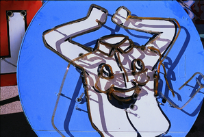
Laundry sign, Nevada: photographic print
Date
Unknown year
Archival Collection
Description
Shirt with face sign.
Image
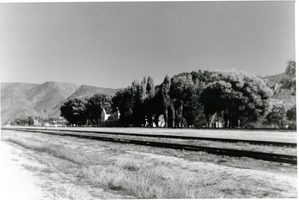
Photograph of U. P. Station, Nevada, circa 1930s
Date
1930 to 1939
Archival Collection
Description
U. P. Station with old club house.
Image
Photograph of Boulder City, Nevada, March 28, 1937
Date
1937-03-28
Archival Collection
Description
The grayscale, aerial view of Boulder City, Nevada. The prominent road of Nevada Way can be seen passing through the little town with the great reservoir of Lake Mead residing in the background.
Image
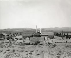
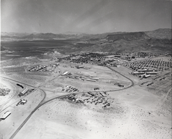
Photograph of Boulder City, Nevada, April 18, 1931
Date
1931-04-18
Archival Collection
Description
The grayscale view of wooden buildings and construction in Boulder City, Nevada.
Image
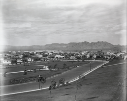
Photograph of Boulder City, Nevada, September 20, 1933
Date
1933-09-20
Archival Collection
Description
The grayscale view from an unidentified park of Boulder City, Nevada.
Image
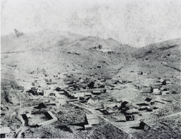
Aerial photograph of Aurora, Nevada, circa 1860s-1910s
Date
1860 to 1919
Archival Collection
Description
Aerial view of the mining town of Auora, Nevada, founded in 1860.
Image
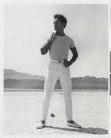
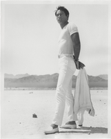
Photograph of Vassili Sulich posing in the desert in Nevada, 1960s
Date
1960 to 1969
Archival Collection
Description
Vassili Sulich standng in the desert in an unknown location in southern Nevada.
Image
Photograph of Vassili Sulich posing in the desert in Nevada, 1960s
Date
1960 to 1969
Archival Collection
Description
Vassili Sulich standng in the desert in an unknown location in southern Nevada.
Image
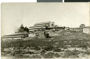
Postcard of a mill, Goldfield, Nevada, circa early 1900s
Date
1900 to 1939
Archival Collection
Description
A view of the Goldfield Consolidated Mill with trestle showing in Goldfield, Nevada.
Image