Search Results

Havilah, Nevada: photographic print
Date
Archival Collection
Description
Image

Blueprint map showing proposed new 12" well and pipe line changes at water springs, Las Vegas, Nevada, circa 1920
Date
Archival Collection
Description
Image
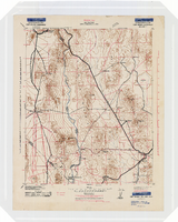
Topographic map of the Camp Mohave quadrangle in California, Nevada and Arizona, 1942
Date
Description
Image
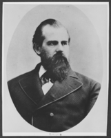
Photograph of Henry Blasdel, Nevada, circa 1861-1870
Date
Archival Collection
Description
Image
People in a Yosemite park area, "Selig moving picture outfit making 'The Rescue of Daniel Boone's Daughter'," (written on verso) Yosemite National Park, California: photographic print, approximately 1900 to 1909
Level of Description
Archival Collection
Collection Name: Leon Rockwell Photograph Collection
Box/Folder: Folder 08
Archival Component

Map of California, territories of New Mexico, Arizona, Colorado, Nevada and Utah, circa 1863
Date
Description
Image
Lincoln Davis, Chicago; R. J. Shoemaker, Rochester, New York; and J. R. Hubbard a mining engineer, Nevada (identified from left to right). Mohawk Ledge Mining Company, Goldfield, Nevada. Inscription reads "I worked for Davis & Shoemaker in office and later at mine after panic hit. This was last work in Goldfield. Shoemaker formerly owned and operated a correspondence school at Rochester, New York": photographic print, approximately 1900-1915
Level of Description
Archival Collection
Collection Name: C. A. Earle Rinker Photograph Collection of Goldfield, Nevada
Box/Folder: Oversized Box SH-066 (Restrictions apply)
Archival Component
Jewish Nevada Records
Identifier
Abstract
The Jewish Nevada Records document the organization's philanthropic activities in Las Vegas, Nevada from 1978 to 2018. The majority of the collection represents the organization's activities under the name the Jewish Federation of Las Vegas. The collection includes administrative files, annual reports, marketing materials, donation records, video recordings of interviews and events, and audio recordings of board meetings. The collection also includes photographic prints and negatives of events hosted by Jewish Nevada.
Archival Collection
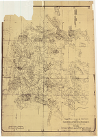
Map of approved mineral surveys in the Goldfield Mining District, Esmeralda and Nye Counties, Nevada, 1911
Date
Description
Image
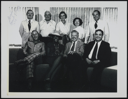
University of Nevada Board of Regents: photographic print
Date
Archival Collection
Description
Image