Search the Special Collections and Archives Portal
Search Results
Smith, A., 1999, 'Telephone Log for Disturbed Area of Muck Pile in a Given Year," personal communication with C. Fosmire (PNNL), February 4, Argonne National Laboratory, Argonne, Illinois, 1999
Level of Description
Archival Collection
Collection Name: Environmental Radiation Protection Standards for Yucca Mountain, Nevada
Box/Folder: Box 22
Archival Component
DOT (U.S. Department of Transportation), Undated, Biennial Report on Hazardous Materials Transportation in Calendar Years 1992-1993, Research and Special Programs Administration, Washington. D.C., undated
Level of Description
Archival Collection
Collection Name: Environmental Radiation Protection Standards for Yucca Mountain, Nevada
Box/Folder: Box 25
Archival Component

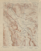
Topographic map of the Furnace Creek quadrangle, Nevada and California, 1947
Date
Description
Text
Dorothy Ray Photograph Collection on Southern Nevada
Identifier
Abstract
The Dorothy Ray Photograph Collection on Southern Nevada, approximately 1900-1946, depicts infrastructure in Caliente, Nevada in the early to mid-twentieth century. The collection also contains images of a flash flood that occurred in 1905 in Carp, Nevada and Stine, Nevada that washed away roads and railroad tracks. This collection provides historical documentation about early to mid-century Caliente, Nevada.
Archival Collection
Beck, Evelyn Ruth, "A five year trend analysis of attitudes of female high school seniors toward post-high school work and education possibilities", 1993 Spring
Level of Description
Archival Collection
Collection Name: University of Nevada, Las Vegas Theses, Dissertations, and Honors Papers
Box/Folder: Box 084
Archival Component
Donald Cowper Henderson, May Stephen Henderson Murray, Nancy Henderson, Margaret Henderson Martin, and their mother Mary, San Bernardino, California, approximately 1900-1905
Level of Description
Archival Collection
Collection Name: Fayle Family Photographs
Box/Folder: Folder 01
Archival Component
Portrait of P.T. Barnum performer Admiral Dot (born Leopold S. Kahn) with his wife Lottie Naomi Swartwood and their children: photographic print, approximately 1900 to 1915
Level of Description
Archival Collection
Collection Name: Leon Rockwell Photograph Collection
Box/Folder: Folder 18
Archival Component
Frank Benham Photograph Collection on Goldfield, Nevada
Identifier
Abstract
The Frank Benham Photograph Collection on Goldfield, Nevada (1900s-1947) primarily contains black-and-white photographic prints of buildings and people in Goldfield, Nevada. Also included in the collection are black-and-white photographic prints of nearby mining towns, as well as postcards and one negative. Frank Benham co-owned a real estate business and served as assistant postmaster for Goldfield in the early 1900s.
Archival Collection

Hotel Nevada billboard, Ely, Nevada
Date
Archival Collection
Description
View of the Hotel Nevada billboard reading "Hotel Nevada Western Hospitality."
501 E Aultman St, Ely, NV 89301
Image
#71385: Cody Hughes, associate professor in residence UNLV School of Dental Medicine and School of Dental Medicine alumni of the year on February 16, 2017, 2017 February 16
Level of Description
Archival Collection
Collection Name: University of Nevada, Las Vegas Creative Services Records (2010s)
Box/Folder: Digital File 01
Archival Component
