Search the Special Collections and Archives Portal

Search Results
Display    Results Per Page
Displaying results 211 - 220 of 556402

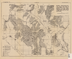
Map showing configuration of potentiometric surfaces in Paleozoic and Cenozoic aquifers in the area between the Las Vegas Valley and the Amargosa Desert, Nevada, 1963

Date

1963

Description

'Department of the Interior, United States Geological Survey. TEI-840.' 'Prepared in cooperation with the U.S. Atomic Energy Commission.' 'Contours in northwest Las Vegas Valley from Malmberg, 1961.' Relief shown by contours. Shows township and range lines. Scale [ca. 1:253,440. 1 in.=aprrox. 4 miles] (W 114°00´--W 115°00´--N 37°00´/N 36°00´). Originally published in A summary of the ground-water hydrology of the area between the Las Vegas Valley and the Amargosa Desert, Nevada : with special reference to the effects of possible new withdrawals of ground water / by Isaac J. Winograd, published by the U.S. Geological Survey in 1963 as number 840 of the Trace elements investigations report.

Image

Nevada Wildlife Bulletin Collection

Identifier

MS-00729

Abstract

The Nevada Wildlife Bulletin Collection contains an incomplete run of bulletins that were published monthly in Reno, Nevada by the Nevada Fish and Game Commission from 1960 to 1965. The Nevada Wildlife Bulletin covered activities of fishing and hunting throughout the state of Nevada.

Archival Collection

Plat of H.F.M & M addition to city of Las Vegas, Clark County, Nevada, comprising the west 1/2 of N.W. 1/4 Sec. 27, Twp. 20 S., R. 61 E., M.D.B & M, March 8, 1924

Date

1924-03-08

Description

Blue-line print ; 74 x 36 cm on sheet 79 x 61 cm. Survey was competed on March 8, 1924. Signed by the owners of the piece of property for the addition Roy W. Martin, Forest R. Mildren, William E. Ferron, and A. W. Ham, signed by the surveyor J.T. McWilliams, and notarized on March 31, 1924. Approved by the Board of City Commissioners and signed by the major W. C. German and by Florence S. Doherty, city clerk, on April 1, 1924. Recorded in Book 1 of plats, page 47. Includes township and range grid.

Image

Nevada Watercolor Society Records

Identifier

MS-00510

Abstract

The Nevada Watercolor Society Records (1969-2009) contain watercolor paintings and organizational records pertaining to the Nevada Watercolor Society, a non-profit organization that aims to promote watermedia painting and art appreciation. Organizational records contain materials including by-laws, articles of incorporation, newsletters, exhibit information, tax and financial records, receipts, photographs, negatives, and newspaper clippings. The collection also includes paintings by society members and newspaper clippings about art exhibitions and artists in Las Vegas, Nevada.

Archival Collection

Photograph of Nevada governors, Nevada, 1973

Date

1973

Description

Nevada Governors from left to right: Charles Russell (seated), Mike O'Callaghan, Paul Laxalt and Grant Sawyer. Note provided on back of photo: "'I received appointments from each to Retirement Board -- and from Laxalt, O' Callaghan and List (not shown) to the State Historical Society Board of Trustees.' -- Elbert Edwards."

Image

Map showing proposed new 12" well and pipe line changes at Water Springs, Las Vegas, Nevada, circa 1920

Date

1916 to 1925

Description

In lower right corner: '6-W-74.' Scale: 1" = 500'.

Image

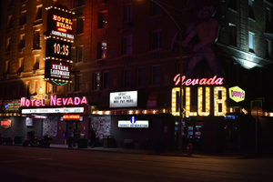
The Nevada Club in Reno, Nevada: postcard, image 001

Description

The Nevada Club in Reno, Nevada.

Hydrogeologic map of Nevada Test Site and vicinity, southern Nevada, 1965

Date

1965

Description

At top of map: ' United States Department of the Interior, Geological Survey. Professional paper 712-C, plate 1. Prepared on behald of the U.S. Atomic Energy Commission.' At bottom of map: 'Base from U.S. Geological Survey, Caliente, Death Valley, Goldfield and Las Vegas, 1954. 100,00-foot grid based on Nevada coordinate system, central zone.' 'Hydrogeology by I. J. Winograd, 1965; geology by William Thordarson.' Relief shown by contours and spot heights. Shows township and range lines. Includes diagram of downward and upward cross-flow of water. Includes bibliographical references and index. Contour interval 200 feet. Scale 1:250,000 (W 117°--W 115°/N 38°--N 36°). Series: Professional paper (Geological Survey (U.S.), 712-C. Issued as plate 1 from Hydrogeologic and hydrochemical framework, south-central Great Basin, Nevada-California with special reference to the Nevada Test Site. Prepared on behalf of the U.S. Atomic Energy Commission by Isaac J. Winograd and William Thordarson. Published 1975 by U.S. Govt. Print. Off. in Washington.

Image

Nevada Poetry Society Records

Identifier

MS-00172

Abstract

The Nevada Poetry Society Records are comprised of the Society's records dating from 1961 to 1973. Society organizer and president, Mildred Breedlove is featured prominently in the collection. Materials include Silver Strings: Nevada Poetry Society Anthology, a collection of poems commemorating Nevada's centennial year, individual poems from members, financial records, correspondence, and newsletters.

Archival Collection
Map of Nevada Railroads, 1911

Date

1911

Description

Scale [ca. 1,710,720]. 1 in. = 27 miles (W 120 --W 114 /N 42 --N 35 ) ; 1 map : col. ; 47 x 31 cm ; Relief shown by hachures ; Title below scale: Rand McNally & Co.'s New business atlas map of Nevada ; Shows railroads ; Includes additional copyright date: c1893 ; Includes township and range grid ; Published as page 321 of Rand-McNally indexed atlas ;

Image