Search Results

Geologic map of the Ammonia Tanks quadrangle, Nye County, Nevada, 1967
Date
1967
Description
58 x 46 cm., on sheet 84 x 100 cm., folded in envelope 30 x 24 cm. Relief shown by contours and spot heights. "Base by U.S. Geological Survey, 1961." "Geology mapped in 1961-65." "Contour interval 20 feet." Includes 3 col. cross sections, 1 index map, text with bibliography, and quadrangle location map. "Prepared in cooperation with the U. S. Atomic Commission." Original publisher: Interior, Geological Survey, Series: Geologic quadrangle map GQ, Scale: 1:24 000.
Image

Geologic map of the Jangle Ridge quadrangle, Nye and Lincoln Counties, Nevada, 1965
Date
1965
Description
58 x 46 cm., on sheet 84 x 87 cm., folded in envelope 30 x 24 cm. Relief shown by contours and spot heights. "Contour interval 20 feet." "Prepared in cooperation with the U.S. Atomic Energy Commission." "Geology mapped in 1961. Limit of pluvial Groom Lake and faults from photographs mapped by R. B. Colton, 1962." Includes text, bibliography, location map, and 5 col. cross sections. Original publisher: Interior, U.S. Geological Survey, Series: Geologic quadrangle map GQ, Scale: 1:24 000.
Image
Geologic Tours in the Las Vegas Area, Expanded Edition, Nevada Bureau of Mines and Geology, 2001
Level of Description
File
Archival Collection
David Donovan Collection on Hydrology and Geology
To request this item in person:
Collection Number: MS-00813
Collection Name: David Donovan Collection on Hydrology and Geology
Box/Folder: Box 35
Collection Name: David Donovan Collection on Hydrology and Geology
Box/Folder: Box 35
Archival Component
Geologic features from the Geologic Survey of Great Britain, 1929 September 24
Level of Description
File
Archival Collection
Chester R. Longwell Professional Papers
To request this item in person:
Collection Number: MS-00017
Collection Name: Chester R. Longwell Professional Papers
Box/Folder: Box 27
Collection Name: Chester R. Longwell Professional Papers
Box/Folder: Box 27
Archival Component
Geological Survey; Geology Geology and Lithologic Log for the Drill Hole UE17a, Nevada Test Site (Nevada Terminal Waste Storage - 1) by U.S. Geological Survey for the Nevada Operations Office, U.S. Department of Energy, 1978 December
Level of Description
File
Archival Collection
Clark County Planning Commission Research Library Collection
To request this item in person:
Collection Number: MS-01027
Collection Name: Clark County Planning Commission Research Library Collection
Box/Folder: Box 74
Collection Name: Clark County Planning Commission Research Library Collection
Box/Folder: Box 74
Archival Component
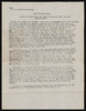
Report from U.S. Geological Survey on pottery
Date
1912
Archival Collection
Description
This folder is from "Maps and Assorted Documents" file of the Sadie and Hampton George Papers (MS-00434)
Text
Nevada Bureau of Mines and Geology Bulletins
Level of Description
File
Archival Collection
David Donovan Collection on Hydrology and Geology
To request this item in person:
Collection Number: MS-00813
Collection Name: David Donovan Collection on Hydrology and Geology
Box/Folder: N/A
Collection Name: David Donovan Collection on Hydrology and Geology
Box/Folder: N/A
Archival Component
Nevada Bureau of Mines and Geology, 1986
Level of Description
File
Archival Collection
David Donovan Collection on Hydrology and Geology
To request this item in person:
Collection Number: MS-00813
Collection Name: David Donovan Collection on Hydrology and Geology
Box/Folder: Box 12
Collection Name: David Donovan Collection on Hydrology and Geology
Box/Folder: Box 12
Archival Component
Geology maps of Southern Nevada, 1991
Level of Description
File
Archival Collection
David Donovan Collection on Hydrology and Geology
To request this item in person:
Collection Number: MS-00813
Collection Name: David Donovan Collection on Hydrology and Geology
Box/Folder: Box 18
Collection Name: David Donovan Collection on Hydrology and Geology
Box/Folder: Box 18
Archival Component
Geology of Elko County, Nevada, 1987
Level of Description
File
Archival Collection
David Donovan Collection on Hydrology and Geology
To request this item in person:
Collection Number: MS-00813
Collection Name: David Donovan Collection on Hydrology and Geology
Box/Folder: Box 46
Collection Name: David Donovan Collection on Hydrology and Geology
Box/Folder: Box 46
Archival Component