Search the Special Collections and Archives Portal
Search Results

Photo Album
Date
1869 (year uncertain) to 1930 (year uncertain)
Archival Collection
Description
Photo Album
Mixed Content
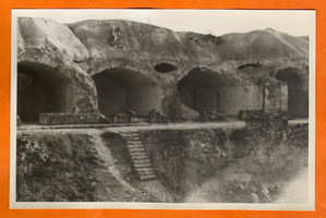
Building or mine remains in Europe: photographic print
Date
1880 to 1979
Archival Collection
Description
Bell Family Scrapbook scanning, Set 4, proofed 11.04.2010 Building or mine remains in Europe
Image
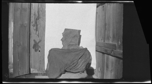
Mine entrance with rock face, image 001 of 002: photographic film
Date
1878 to 1954
Archival Collection
Description
Entrance to a mine, location unknown. A rock sits at the entrance that looks like the profile of a face on the left.
Image
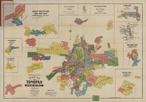
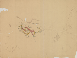
Map of Tonopah Mining District, Nevada, revised edition, 1903
Date
1903
Description
'Compiled and published by Booker & Bradford, engineers, Tonopah, Nevada.' 'Copyrighted by Booker & Bradford 1903.' 'Photo-Lith. Britton & Rey, S.F.' Insets of Ray Mining District, vicinity map of Tonopah Mining District, Utopia Mining District, Tokop Mining District, Weepah Mining District, East Klondike Mining District, Gold Mountain, Tonopah Mining District and Red Mountain. Relief shown by hachures. Includes advertisements. Scale [ca. 1:10,800]. 1 inch to 900 feet.
Image
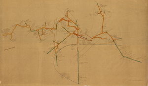
Map of the 450 foot level of the Mohawk Mine, Goldfield, Nevada, circa 1902-1908
Date
1902 to 1908
Description
'(3rd) 450 Ft. level Mohawk.' Hand-drawn, hand-colored and annotated map showing the 450 foot, or third, level of the Mohawk Mine.
Image
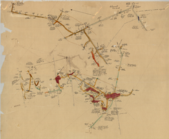
Map of the 280 foot level of the Combination Mine, Goldfield, Nevada, circa 1902-1908
Date
1902 to 1908
Description
Hand-drawn, hand-colored and annotated map showing the 280 foot level of the Combination Mine. Printed on map: 'Mohawk, col. el. 5958.48; Hayes & Monnette No. 2, col. el. 5935.7; Hayes & Monnette No. 1, col. el. 5925.8; Truett, col. el. 5938.8; Combination, col. el. 5986.31.'
Image
Map of the 600 foot, or third, level of the Clermont Mine, Goldfield, Nevada, circa 1902-1908
Date
1902 to 1908
Description
Hand-drawn, hand-colored and annotated map showing the 600 foot, or third, level of the Clermont Mine. Handwritten at top of map: 'Clermont, 3rd level.'
Image

Correspondence, Thomas Toland to Levi Syphus
Date
1925-03-06
Archival Collection
Description
This folder is from the "Correspondence" file of the Sadie and Hampton George Papers (MS-00434)
Text

Transcript of interview with Bertha Gresh by James M. Green, November 1, 1974
Date
1974-11-01
Archival Collection
Description
On November 1, 1974, collector James M. Greene, interviewed widow and mine leaser, Bertha Gresh (born August 29th, 1883, in Cedarburg, Wisconsin) in her home in Nelson, Nevada. This interview covers early mining days, Bertha’s personal history, and the history of Nelson County. She also discusses her art, social activities, and the prizes she won as a visual artist in Nevada.
Text
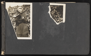
Photo Album
Date
1869 (year uncertain) to 1940 (year uncertain)
Archival Collection
Description
An album containing family photos. A mining claim belonging to Evaline Stay, dated June 25, 1933, is also included.
Mixed Content
Pagination
Refine my results
Content Type
Creator or Contributor
Subject
Archival Collection
Digital Project
Resource Type
Material Type
Place
Language
Records Classification
