Search Results
Receipt: Sadie George
Date
Archival Collection
Description
Text
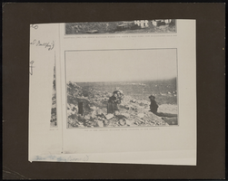
Top of the original Bullfrog Mine in Sunset Magazine: ephemera
Date
Description
Image
Photograph of 1200 foot level, Belmont Mine in Tonopah (Nev.), 1911
Date
Archival Collection
Description
Image
Ferron and Bracken Photograph Collection
Identifier
Abstract
The Ferron and Bracken Photograph Collection depicts Southern and Central Nevada and other western states from 1890 to 1961. The photographs primarily depict the development and growth of early Las Vegas, Nevada; mines and mining operations in Southern and Central Nevada; towns and mines in Nevada; and the Hoover (Boulder) Dam and the Colorado River.
Archival Collection
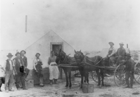
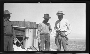
Camp in Railroad Valley: photographic print
Date
Archival Collection
Description
From the Nye County, Nevada Photograph Collection (PH-00221) -- Series VII. Other areas in Nye County -- Subseries VII.E. Hawkins Family (Duckwater, Nevada). A camp in Railroad Valley, Nye County, Nevada, in the vicinity of present-day (1990) oil fields where Isaac "Ike" Irwin drilled for potash. Seated in the wagon wearing a white shirt is Frank Roberts and beside him is Jess Hildebrandt, a resident of Duckwater, Nevada. This photograph is undated, but judging by Frank Robert’s age in the photo it appears to be circa 1915.
Image

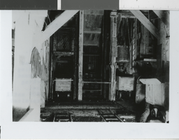
Mine entrance with rock face, image 002 of 002: photographic film
Date
Archival Collection
Description
Image
Giles and miners holding pickaxes: photographic film
Date
Archival Collection
Description
Image

Photo Album
Date
Archival Collection
Description
Mixed Content
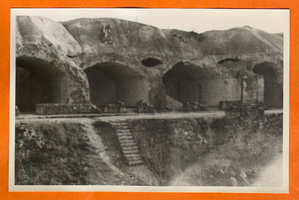
Building or mine remains in Europe: photographic print
Date
Archival Collection
Description
Bell Family Scrapbook scanning, Set 4, proofed 11.04.2010 Building or mine remains in Europe
Image
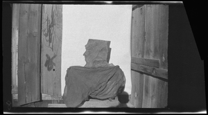
Mine entrance with rock face, image 001 of 002: photographic film
Date
Archival Collection
Description
Image