Search the Special Collections and Archives Portal
Search Results

Manganese Incorporated: photographic print
Date
Archival Collection
Description
Manganese Inc. (Operated Three Kids Mine) [c. 1950's]
Image
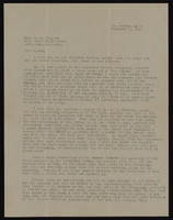
Correspondence, Levi Syphus to Sadie B. Clayton
Date
Archival Collection
Description
Text
Fayle Family Photographs
Identifier
Abstract
The Fayle Family Photographs depict the Fayle Family in Southern Nevada and California from 1888 to 1990. The photographs primarily include family photographs of Leonard Fayle, Anna Louise Trapnell Fayle, Leonard Fayle’s parents George Fayle and Jean Henderson Fayle, Leonard Fayle’s siblings George Arthur Fayle and Jean Nevada Fayle, and Leonard and Anna Fayle’s children Jane and Edward Fayle. The photographs also depict the Nevada towns of Las Vegas, Goodsprings, and Jean, including railroad operations, mining, milling, and hauling freight. The collection includes a leather-bound photograph album containing images of the Fayle Family and the Yount Family.
Archival Collection
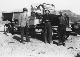
David Walker "Deke" Lowe, Jr. and others at Noonday Mine: photographic print
Date
Archival Collection
Description
From the Nye County, Nevada Photograph Collection (PH-00221) -- Series VII. Other areas in Nye County -- Subseries VII.F. Lowe Family. Dr. Lincoln. D. Godshall, the mine's owner (Manager), is on the left, David Walker "Deke" Lowe, Jr., is in the middle and a man known only as Uncle Billy, the watchman at the mine for many years, is on the right.
Image
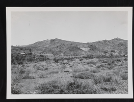
Mining operations: photographic print
Date
Archival Collection
Description
Image
Tonopah-Goldfield Mining Photograph Collection
Identifier
Abstract
The Tonopah-Goldfield Mining Photograph Collection depicts mining activities in the mining towns of Tonopah and Goldfield in Esmeralda County, Nevada from approximately 1901 to 1920. The photographs primarily depict mines, miners, mills, construction, ore, and workers transporting ore. The photographs also depict events and people in Tonopah and Goldfield, including parades, celebrations, banquets, children, Native Americans, and prominent buildings.
Archival Collection
Elbert Edwards Photograph Collection
Identifier
Abstract
The Elbert Edwards Photograph Collection contains photographs of Nevada from 1852 to 1991. The collection has a wide variety of photographs, including: white pioneers and settlers; early Nevada towns; Nevada politicians; early Las Vegas landmarks; Boulder City schools; petroglyphs from Nevada's indigenous populations; Lost City and Lake Mead; railroads; the Hoover Dam (Boulder Dam); Basic Magnesium Inc. in Henderson, Nevada; geographical features; the Edwards family; and photographs of Elbert Edwards's participation in the Las Vegas Education Association and the Rotary Club.
Archival Collection
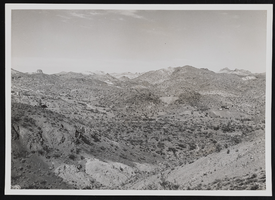
Nelson mining district: photographic print
Date
Archival Collection
Description
Image
Bill Beam Papers
Identifier
Abstract
The Bill Beam Papers document the career of miner and poetry enthusiast Bill (William) Beam from 1955 to 2004. The papers contain mining materials, photographs, and poetry from mines Beam worked in around the Southwestern United States. Also included are two albums of photographs from the Nevada Test Site.
Archival Collection
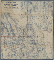
Miners map of Death Valley and the proposed Salt Lake railroads, January 1903
Date
Description
Image
