Search the Special Collections and Archives Portal

Search Results

Display    Results Per Page
Displaying results 7451 - 7460 of 19602

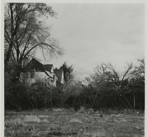
Residence: McHaffie

Level of Description

File

Scope and Contents

This set includes: exterior elevations, interior elevations, floor plans, foundation plans, index sheet, site plans, roof plans, framing plans, wall sections, building sections, finish/door/window schedules, electrical plans, construction details, HVAC plans and exterior perspectives.

This set includes drawings for Mr and Mrs Charles McHaffie (client) by Daniel P. Smith (engineer).

Archival Collection

Gary Guy Wilson Architectural Drawings
To request this item in person:
Collection Number: MS-00439
Collection Name: Gary Guy Wilson Architectural Drawings
Box/Folder: Roll 418

Archival Component

Tropicana Park: Rackset

Level of Description

File

Scope and Contents

This set includes: index sheet, site plans, landscape plans, floor plans, exterior elevations, foundation plans, framing plans, building sections construction details, interior elevations, finish/door/window schedules, general specifications, reflected ceiling plans, HVAC plans, plumbing plans, plumbing schematics, electrical plans and electrical schematics.

This set includes drawings for the Mueller Group (client).

Archival Collection

Gary Guy Wilson Architectural Drawings
To request this item in person:
Collection Number: MS-00439
Collection Name: Gary Guy Wilson Architectural Drawings
Box/Folder: Roll 568

Archival Component

Architectural drawings and maps, 1943 to 1985

Level of Description

Series

Scope and Contents

The architectural drawings and maps series (1943-1985) contain projects and diagrams primarily pertaining to the planning and development of Boulder City, Nevada. The series also includes drawings from Las Vegas, Nevada, locations throughout Southern Nevada including Lake Mead, and California. Drawing types include master site plans and zoning maps for Boulder City and its subdivisions, architectural drawings for residential homes, railroad track maps, and topographic maps.

Archival Collection

Elton and Madelaine Garrett Photograph and Architectural Drawing Collection
To request this item in person:
Collection Number: PH-00265
Collection Name: Elton and Madelaine Garrett Photograph and Architectural Drawing Collection
Box/Folder: N/A

Archival Component

Edgewater Hotel: Wilson Copy, 1983 May 12; 1983 May 17

Level of Description

File

Scope and Contents

This set includes: index sheet, construction details, foundation plans, framing plans, wall sections, site plans, exterior elevations, roof plans, preliminary sketches, building sections, floor plans, exiting plans, electrical plans, electrical schematics, lighting plans, fixture schedule, HVAC plans, interior elevations and finish/door schedules.

Archival Collection

Gary Guy Wilson Architectural Drawings
To request this item in person:
Collection Number: MS-00439
Collection Name: Gary Guy Wilson Architectural Drawings
Box/Folder: Roll 164

Archival Component

Map showing the proposed improvement of Las Vegas Springs, Las Vegas (Nev.), Clark County (Nev.), 1916

Date

1916

Description

Scale [ca. 1:240]. 1 in. to 20 feet. -- Scale [ca. 1:2,400]. 1 in. to 200 ft. Vertical scale [ca. 1:48]. 1 in. to 4 feet. -- Scale [ca. 1:4,800]. 1 in. to 100 feet ; 1 map : col. ; 40 x 78 cm ; "Scale as noted." ; "Exhibit 'A'." ; "Approved Sept. 21, 1916." ; "Div.Engr."--Lower right corner ; "W.E.J."--Lower left corner ; "L-44-50to61. T-75-17&46."--Upper left corner ; Includes discharge figures and plans for improvements to springs ; Library's copy has "Proposed layout" written on it in pencil ; Contents: Detail at springs -- Profile -- Alignment ;

Image

Topographic map of Cane Spring, Nevada quadrangle, 1961

Date

1961

Description

'Mapped, edited and published by the Geological Survey in cooperation with the Atomic Enegry Commission. Control by USGS, USC&GS, USCE, and Atomic Energy Commission. Topography from aerial photographs by photogrammetric methods. Aerial photographs taken 1959. Field check 1961.' Scale 1:24,000 polyconic projection (W 116°07'30"--W 116°00'00"/N 36°52'30"--N 36°45'00"). Series: 7.5 minute series (topographic). Relief shown by contours and spot heights. Contour interval 20 feet. Includes quadrangle location map. Interior--Geological Survey
For sale by the U.S. Geological Survey

Image

Photographs of East Fremont Street signs, Las Vegas (Nev.), 2016

Date

2016-01-31
2016-04-10
2016-04-28

Description

The neon signs including a red slipper, martini glass, the Buxom Beauty in a Neon Bikini and others sit along E Fremont St in Downtown Las Vegas
Site name: Fremont Street (Las Vegas, Nev.)
Site address: Fremont St
Sign keywords: Neon; Incandescent; Back to back; Sculptural; Pole sign; Oscillating

Mixed Content

Photograph of rock and gravel plant, Hoover Dam, circa 1930-1935

Date

1930 to 1935

Archival Collection

Description

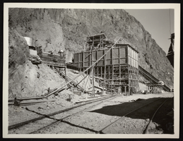
An image of the completed rock and gravel plant at the Hoover (Boulder) Dam construction site. Noted on the photo: "Taken by FAB."

Image

Postcard of the intake towers at Hoover Dam, circa 1935

Date

1935

Archival Collection

Description

A view of the completed intake towers and the rising waters of Lake Mead at the recently constructed Hoover (Boulder) Dam site.

Image