Search the Special Collections and Archives Portal

Search Results
Display    Results Per Page
Displaying results 15841 - 15850 of 18569

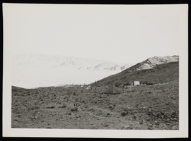
Photograph of work camps, Boulder City (Nev), circa 1933

Date

1932 to 1934

Description

Tent camps for people waiting for work at the Dam, located just before Railroad Pass. Note on back ""Ross kept a sidewinder in a box on rt. side of water ladys tent (tent in backghround at right). Ross' camp (left, background). He was bitten by the rattlesnake. Location where elderly lady sold water at the top of the Pass. $0.05 glass and $0.25 to fill a radiator. Guss Nugeat's mine out of picture to the left. Only about 5 cars a day came by in 1930."" - W.A. Davis

Image

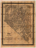
Map of the state of Nevada, 1886

Date

1886

Description

'Compiled by John W. Parker, chief draughtsman of the U.S. Sur. General's Office, Reno, Nevada, from official maps on file on the office, War Department maps and other reliable data. 1886.' 'Entered according to act of Congress, in the year 1886, by John W. Parker, in the office of the Librarian of Congress at Washington.' Relief shown by hachures. Shows townships, including which townships are subdivided, roads, railroads, Indian reservations, etc. Shows range and township grid. Scale [1:760,320]. 1 in. to 12 miles (W 120°--W 114°/N 42°--N 35°).

Image

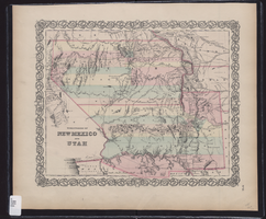
Map showing the territories of New Mexico and Utah, 1855

Date

1855

Description

'Entered according to Act of Congress in the year 1855 by J.H. Colton & Co. in the Clerk's Office of the Dist. Court of the U.S. for the South'n. Dist. of New York.' Scale [ca. 1:4,752,000. 1 in. to approx. 75 miles] (W 120°--W 102°/N 43°--N 32°). Shows natural features, and populated places, wagon route, proposed railroad routes and explorers' routes. Relief shown by hachures. Prime meridians: Greenwich and Washington.Hand colored. Atlas p. number in lower-right margin: 51. Decorative border. J.H. Colton & Co.

Image

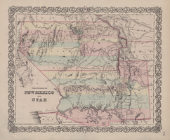
Map of territories of New Mexico and Utah, 1855

Date

1855

Description

29 x 36 cm. Shows natural features, and populated places, wagon route, proposed railroad routes and explorers' routes. Relief shown by hachures. Prime meridians: Greenwich and Washington. "Entered according to act of Congress in the year 1855 by J.H. Colton & Co in the Clerk's Office of the District Court of the U.S. for the Southern District of New York." Hand colored. Atlas p. number in lower-right margin: 51. Decorative border. The geographic region of Southwest is referred to as the New Southwest. Original publisher: J.H. Colton .

Image

Ferrell, Mallory Hope

A former combat fighter pilot and international airline captain, the Virginia native has authored hundreds of articles and written 21 books. Mallory was a photographer for the Black Star Agency and Life magazine before turning to a professional flying career. He still does photographic work the “old-fashioned way” in his own darkroom. His picture collection on railroads and the Old West numbers well over 120,000 prints.

Source: http://www.signaturepress.com/authors/mhf.html

Person

Photographs, Schedules, and Instruction Books, 1905-1958

Level of Description

Sub-Series

Scope and Contents

The Photographs, Schedules, and Instruction Books sub-series (1905-1958) contains photographs of buildings and railway sections, maps, employee operations and instruction books, pay schedules, and related information.

Archival Collection

Union Pacific Railroad Collection
To request this item in person:
Collection Number: MS-00397
Collection Name: Union Pacific Railroad Collection
Box/Folder: N/A

Archival Component