Search the Special Collections and Archives Portal
Search Results
Goodsprings Mining District
Authority Link
No description.
Latitude/Longitude
35.84553, -115.50028
Alternate Name
Potosi Mining District
Yellow Pine Mining District
Broader
Feature
administrative division
Geographic Location
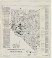
Earthquake epicenter map of Nevada, December 1964
Date
1964-12
Description
Scale 1:1,000,000 (W 120°--W 114°/N 42°--N 35°). Title in upper right margin: Earthquake epicenter map ; "Nevada earthquake epicenters for the period from about 1852 to 1961 are plotted on the accompanying map." ; "Contour interval 1,000 feet." ; "Supported by grant no. AF-AFOSR-62-285 of the Air Force of Scientific Research." ; "December 1964." ; "Base from NBM Map 17." ; "One million scale set." ; Includes bibliographical references ; Includes text and index. Nevada Bureau of Mines, University of Nevada
Text
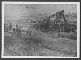
Photograph of loading tailings, Lincoln County, Nevada, circa 1910
Date
1910
Archival Collection
Description
Loading tailings at Bullionville Mine.
Image
Pagination
Refine my results
Content Type
Creator or Contributor
Subject
Archival Collection
Digital Project
Resource Type
Year
Material Type
Place
Language
Records Classification

