Search Results
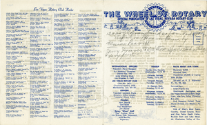
The Wheel of Rotary Las Vegas Rotary Club newsletter, October 27, 1949
Date
Archival Collection
Description
Text
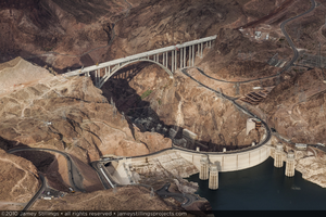
Photograph of the Mike O'Callaghan-Pat Tillman Memorial Bridge mostly completed with roadways leading to the bridge still under construction, Nevada-Arizona border, July 31, 2010
Date
Archival Collection
Description
Image
Progress Report for J. H. Wittwer, 1940-41 program
Date
Archival Collection
Description
List of activities and projects worked on by John Wittwer in 1940-41. Report has penciled comments in several places.
Text
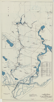
Map and operational diagram, lower Colorado River, Lees Ferry to Gulf of California, May 1957
Date
Description
Image
Las Vegas Rotary Club 50th Anniversary Program, 1973
Date
Archival Collection
Description
Text
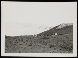
Photograph of work camps, Boulder City (Nev), circa 1933
Date
Archival Collection
Description
Image
Henderson Public Library Photograph Collection on Henderson, Nevada
Identifier
Abstract
The Henderson Public Library Photograph Collection on Henderson, Nevada (approximately 1940-1988) depicts life and growth in Southern Nevada. The collection documents the growth of Henderson, Nevada through images of Basic Magnesium Incorporated, housing throughout the area, and events. The documentation of Basic Magnesium Incorporated, its activites, personnel, and buildings from 1942 through 1944 is prominent in this collection.
Archival Collection
The Wheel of Rotary Las Vegas Rotary Club newsletter, May 18, 1950
Date
Archival Collection
Description
Text