Search the Special Collections and Archives Portal

Search Results

Display    Results Per Page
Displaying results 1861 - 1870 of 2289

Map showing detailed topography of the country traversed by the reconnaissance expedition through southern & southeastern Nevada, 1869

Date

1869

Description

At top of map: 'Reconnaissance Maps, Department of California.' In lower right corner: 'Photolith. by the N.Y. Lithg. Engrg. & Prtg. Co.' 'In charge of, Lieut. Geo. M. Wheeler, U.S. Engineers; assisted by Lieut. D.W. Lockwood, Corps of Engineers,U.S.A., 1969.' 'P.W. Hamel, chief topographer and draugthsman.' 'Officially compiled and published at the Engineer Office, Head Quarters Department of California in 1869 and 70 by order of Brigadier General E.O.C. Ord. Comm'dg. [signed] Geo. M. Wheeler, Lieutenant of Engineers In Charge, Head Quarters Dept. of Cal. Oct. 26th, 1870.' Includes information from railroad maps, the United States Geological Survey of the 40th parallel and from Lieutenant Ives' explorations along the Colorado. Map includes camps, astronomical stations, good and bad wagon roads, trails, springs, settlements, mining districts, state and county boundaries and the watershed between the Humboldt and Colorado Basin. Shows most of eastern half of Nevada. Relief shown by hachures and spot heights. Scale: [1:760,320]. 1 in. to approx. 12 miles. (W 117°00´--W 113°00´/N 41°45´--N 35°45´). Series: Reconnaissance maps. Military map / Department of California
no. 1.miles. Library's copy has counties hand-outlined in colored markers.

Image

Meeting minutes for Consolidated Student Senate, University of Nevada, Las Vegas, July 31, 2000

Date

2000-07-31

Description

Includes meeting minutes and agenda. CSUN Session 30 (Part 1) Meeting Minutes and Agendas.

Text

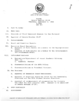
Meeting minutes for Consolidated Student Senate, University of Nevada, Las Vegas, September 19, 2005

Date

2005-09-19

Description

Includes meeting minutes. CSUN Session 35 Meeting Minutes and Agendas.

Text