Search Results
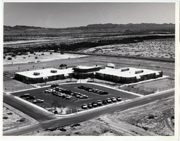
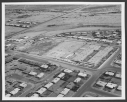
Aerial photograph of Elbert Edwards Elementary School, Las Vegas, Nevada, circa 1970s-1980s
Date
1970 to 1989
Archival Collection
Description
Aerial view of Elbert Edwards Elementary School, parking lot and surrounding desert, Las Vegas, Nevada.
Image
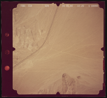
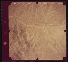
Aerial photograph of a desert, Henderson (Nev.), June 5, 1980
Date
1991-05-20
Archival Collection
Description
Photograph of a desert scene somewhere in Henderson, Nevada.
Image
Aerial photograph of a desert, Henderson (Nev.), June 5, 1980
Date
1991-05-20
Archival Collection
Description
Photograph of an unidentified desert in the Henderson area.
Image
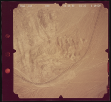
Aerial photograph of a wasteland, Henderson (Nev.), June 5, 1980
Date
1991-11-11
Archival Collection
Description
Photograph of an unidentified desert wasteland somewhere in Henderson, Nevada.
Image
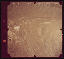
Aerial photograph of the desert, Henderson (Nev.), June 5, 1980
Date
1992-03-14
Archival Collection
Description
Photograph of the desert land near Henderson, NV.
Image
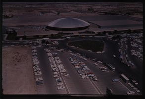
Color aerial view of the Las Vegas Convention Center.
Date
1950 to 1969
Description
Arrangement note: Series V. Glass slidesSite name: Las Vegas Convention Center
Image
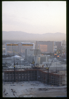
Bellagio resort under construction, Las Vegas, Nevada: aerial photograph
Date
1996-05-30
Archival Collection
Description
Photographs from the Greg Cava Photograph Collection -- Chronological shoots -- 1994-1997 -- Job #96-497: Aerial of Bellagio for The Mirage file.
Image
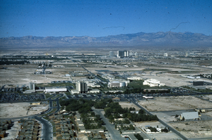
Slide of aerial view of University of Nevada, Las Vegas campus, circa 1972-1975
Date
1972 to 1975
Archival Collection
Description
Aerial view, looking west, of the University of Nevada, Las Vegas campus. The photo shows the entire campus from Tonopah residence hall on the south to the Judy Bayley Theater on the north and Frazier Hall on the east to the EPA buildings on the west. Intersection of Maryland Parkway and Harmon Ave. is seen in the foreground.
Image
Aerial photograph of Lincoln Elementary School, North Las Vegas, Nevada, circa 1960s-1970s
Date
1960 to 1979
Archival Collection
Description
An aerial view of Lincoln Elementary School, North Las Vegas, Nevada, circa 1960s-1970s. The School is located near the intersection of Civic Center Drive and Cheyenne Avenue.
Image
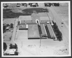
Aerial photograph of Mountain View Elementary School, Las Vegas, Nevada, circa 1960s-1970s
Date
1960 to 1979
Archival Collection
Description
An aerial view of Mountain View Elementary School, Las Vegas, Nevada, circa 1960s-1970s. The school is located near the intersection of Nellis Boulevard and Lake Mead Boulevard.
Image