Search Results
Nevada Women's Archives Records
Identifier
Abstract
Records (1994-1999) are comprised of planning documents, newspaper clippings, external communication, and memoranda documenting the establishment and operations of the Nevada Women's Archives at the University of Nevada, Las Vegas. The records primarily document collection materials from the first exhibit created using the Nevada Women's Archive.
Archival Collection
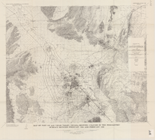
Map of part of Las Vegas Valley, Nevada, showing changes in the piezometric surface between February 1955 and February 1956
Date
Description
Image
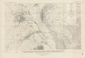
Map of part of Las Vegas Valley, Nevada, showing approximate area and areal densities of phreatophytes and areas in cultivation in 1912
Date
Description
Image
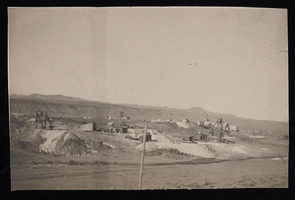
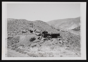
Mines at Milltown, Nevada: photographic print
Date
Archival Collection
Description
Image

Map of Lincoln County, Nevada and Mohave County, Arizona area, 1892
Date
Description
Image

Hotel Nevada and Nevada Club wall and roof mounted signs, Ely, Nevada
Date
Archival Collection
Description
View of the signs for the Hotel Nevada and Nevada Club, including a closeup of a slot machine sign.
501 E Aultman St, Ely, NV 89301
Image
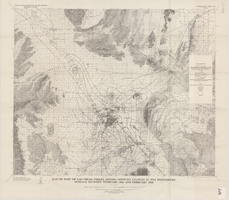
Map of part of Las Vegas Valley, Nevada, showing changes in the piezometric surface between February 1944 and February 1956
Date
Description
Image
Candelaria Ruins of Mt. Diablo, Nevada: photographic prints
Date
Description
Image
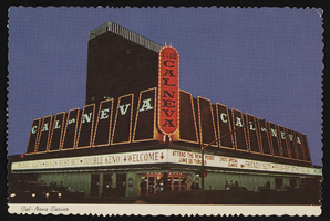
Club Cal Nevada in Reno, Nevada: postcard
Date
Archival Collection
Description
Image

Club Cal Nevada in Reno, Nevada: postcard
Date
Archival Collection
Description
Image