Search the Special Collections and Archives Portal

Search Results

Display    Results Per Page
Displaying results 211 - 220 of 574893

Nevada Women's Archives Records

Identifier

UA-00052

Abstract

Records (1994-1999) are comprised of planning documents, newspaper clippings, external communication, and memoranda documenting the establishment and operations of the Nevada Women's Archives at the University of Nevada, Las Vegas. The records primarily document collection materials from the first exhibit created using the Nevada Women's Archive.

Archival Collection

Club Cal Nevada in Reno, Nevada: postcard

Date

1940 (year approximate) to 1990 (year approximate)

Description

From the Harvey's Hotel and Casino Postcard Collection (PH-00367) -- Club Cal Nevada in Reno, Nevada at night

Image

Map of Lincoln County, Nevada and Mohave County, Arizona area, 1892

Date

1892

Description

'Henry Gannett, chief geographer ; A.H. Thompson, geographer in charge ; triangulation by H.M. Wilson ; topography by H.M. Wilson and Powell survey.' 'Edition of Mar. 1892, reprinted 1929.' Handwritten legend on right-side margin of map. Original publisher: Dept. of the Interior, U.S. Geological Survey. Scale 1:250,000
polyconic proj. (W 115°--W 114°/N 37°--N 35°).

Image
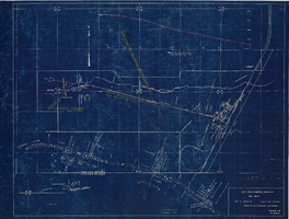
Map showing profile of 24-inch cast iron water pipeline for Las Vegas, Nevada, May 20, 1930

Date

1930-05-20

Description

'As constructed. Drawing W.O. - 8577. Office of Chief Engineer, Los Angeles. Drawing No. 41092.' 'Scale for details 1"=10'. 5-20-1930. P.F.D.' 'Scale 1"=100'.' 'Profile of new 24" CI pipe. Scale 1"=600'. Ver. 1"=20'.' Blueprint. Map of the water pipes for Las Vegas. Includes the buildings in the railroad yard, a detailed map of a section of the pipe, a profile of the 24 inch C.I. pipe, and a map of the point of diversion. Date of detailed map is 5-20-1930. Library's copy has hand-written additions in color. Los Angeles & Salt Lake Railroad Co., Office of Chief Engineer,

Image

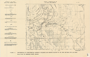
Map showing configuration of potentiometric surfaces in Paleozoic and Cenozoic aquifers in the area between the Las Vegas Valley and the Amargosa Desert, Nevada, 1963

Date

1963

Description

'Department of the Interior, United States Geological Survey. TEI-840.' 'Prepared in cooperation with the U.S. Atomic Energy Commission.' 'Contours in northwest Las Vegas Valley from Malmberg, 1961.' Relief shown by contours. Shows township and range lines. Scale [ca. 1:253,440. 1 in.=aprrox. 4 miles] (W 114°00´--W 115°00´--N 37°00´/N 36°00´). Originally published in A summary of the ground-water hydrology of the area between the Las Vegas Valley and the Amargosa Desert, Nevada : with special reference to the effects of possible new withdrawals of ground water / by Isaac J. Winograd, published by the U.S. Geological Survey in 1963 as number 840 of the Trace elements investigations report.

Image

Main Street, Goldfield, Nevada, postcard

Description
Postcard of Main Street, Goldfield, Nevada.

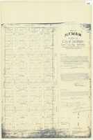
Plat of H.F.M & M addition to city of Las Vegas, Clark County, Nevada, comprising the west 1/2 of N.W. 1/4 Sec. 27, Twp. 20 S., R. 61 E., M.D.B & M, March 8, 1924

Date

1924-03-08

Description

Blue-line print ; 74 x 36 cm on sheet 79 x 61 cm. Survey was competed on March 8, 1924. Signed by the owners of the piece of property for the addition Roy W. Martin, Forest R. Mildren, William E. Ferron, and A. W. Ham, signed by the surveyor J.T. McWilliams, and notarized on March 31, 1924. Approved by the Board of City Commissioners and signed by the major W. C. German and by Florence S. Doherty, city clerk, on April 1, 1924. Recorded in Book 1 of plats, page 47. Includes township and range grid.

Image

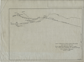
Map showing proposed new 12" well and pipe line changes at Water Springs, Las Vegas, Nevada, circa 1920

Date

1916 to 1925

Description

In lower right corner: '6-W-74.' Scale: 1" = 500'.

Image

Hotel Nevada Guest Register

Identifier

MS-00634

Abstract

The Hotel Nevada Guest Register (1910-1911) consists of one register from the Hotel Nevada, which opened on the southeast corner of Main Street and Fremont Street in Las Vegas, Nevada in 1906. This particular volume lists guest names and their home citieslocated on the corner of Fremont and Main Streets.

Archival Collection

Photograph of Nevada governors, Nevada, 1973

Date

1973

Description

Nevada Governors from left to right: Charles Russell (seated), Mike O'Callaghan, Paul Laxalt and Grant Sawyer. Note provided on back of photo: "'I received appointments from each to Retirement Board -- and from Laxalt, O' Callaghan and List (not shown) to the State Historical Society Board of Trustees.' -- Elbert Edwards."

Image