Search the Special Collections and Archives Portal
Search Results

Meeting minutes for Consolidated Student Senate, University of Nevada, Las Vegas, November 14, 2005
Date
Archival Collection
Description
Text
Red Rock Canyon National Conservation Area Records
Identifier
Abstract
The Red Rock Canyon National Conservation records (1965-2007) contain information about the Red Rock Canyon National Conservation Area (previously the Red Rock Canyon Recreation Lands). It largely consists of newspaper clippings on a variety of events related to Red Rock Canyon from 1965 to 1998 with the bulk from the 1980s and 1990s. The records also include Bureau of Land Management documents pertaining to interpretive efforts, visitation statistics, and law enforcement reports. Also included are the newsletters (1990-1998) and volunteer training manual of the Friends of Red Rock Canyon, a non-profit volunteer organization.
Archival Collection
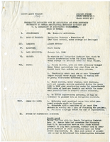
County agent project report, Cooperative extension work in agriculture and home economics, 1929
Date
Archival Collection
Description
Summary of plan for organizing an irrigation district in the Moapa Valley for flood control, water storage, and drainage. Project Number: State Office # M-282, Clark County # M-22
Text
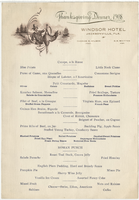
Thanksgiving dinner menu, Windsor Hotel, 1908
Date
Archival Collection
Description
Text
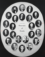
Photograph of Governors of Nevada plaque, Boulder City, Nevada, circa 1960s-1970s
Date
Archival Collection
Description
Image
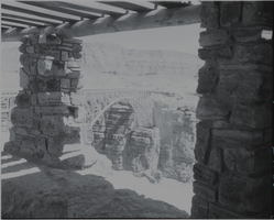
Film transparency of of the Navajo Bridge, Grand Canyon, Arizona, circa 1930s
Date
Archival Collection
Description
Image
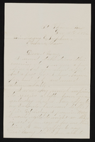
Letter (no envelope) from John M. Bunker, St. Thomas, Nevada to Mary Etta Syphus, Panaca, Nevada
Date
Archival Collection
Description
From the Syphus-Bunker Papers (MS-00169). The folder contains an original handwritten letter, a typed transcription of the same letter, and a copy of original letter attached.
Text
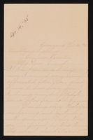
Letter (envelope missing) from Laura Lyman. Parowan, Utah to Mary Syphus, Panaca, Nevada
Date
Archival Collection
Description
From the Syphus-Bunker Papers (MS-00169). The folder contains an original handwritten letter, a typed transcription of the same letter, and a copy of original letter attached. Laura's last name "Lyman" is not included in letter or title, but there is correspondence with previous letter and location of Parowan, Utah.
Text

