Search Results
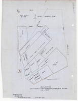
Plat showing cultivated land in the Stewart Ranch, Las Vegas, Nevada, December 8, 1902
Date
Archival Collection
Description
Image
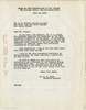
Letter from E. C. Adams (San Francisco) to Al Folger (Las Vegas), July 15, 1949
Date
Archival Collection
Description
Letter accompanying a report from the Board of Fire Underwriters of the Pacific for Las Vegas.
Text
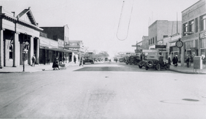
Photograph of businesses on Fremont Street, Las Vegas, Nevada, January 5, 1926.
Date
Archival Collection
Description
Image

Slide of showgirls performing in "Lido de Paris," Las Vegas, 1966
Date
Archival Collection
Description
Image
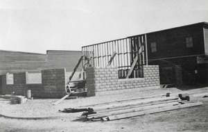
Photograph of bank building under construction, Las Vegas, circa 1905
Date
Archival Collection
Description
Image
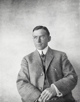
Photograph of Royce Wood Martin, Las Vegas, circa early 1900s
Date
Archival Collection
Description
Image
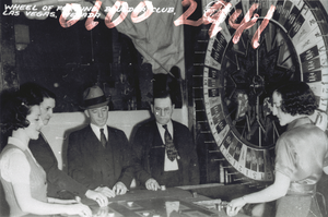
Film transparency showing the Boulder Club, Las Vegas, circa 1940s
Date
Archival Collection
Description
Image
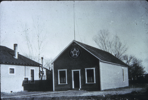
Slide of American Legion Building, Las Vegas, circa early 1910 - 1930s
Date
Archival Collection
Description
Image
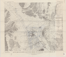
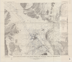
Map of part of Las Vegas Valley, Nevada, showing the piezometric surface in February 1955
Date
Description
Relief shown by contours. Includes township and range lines. Scale 1:96,000 (W 115°30´--W 114°45´/N 36°30´--N 36°00´). Series: Water-supply paper (Washington, D.C.)
1780. Originally published as plate 3 of Available water supply of the Las Vegas ground-water basin, Nevada, by Glenn T. Malmberg, published by the Geological Survey in 1965 as its Water-supply paper 1780.
Image
Map of part of Las Vegas Valley, Nevada, showing the piezometric surface in September 1955
Date
Description
Relief shown by contours. Includes township and range lines. Scale 1:96,000 (W 115°30´--W 114°45´/N 36°30´--N 36°00´). Series: Water-supply paper (Washington, D.C.)
1780. Originally published as plate 4 of Available water supply of the Las Vegas ground-water basin, Nevada, by Glenn T. Malmberg, published by the Geological Survey in 1965 as its Water-supply paper 1780.
Image