Search Results
Nevada Desert Experience Records
Identifier
Abstract
The Nevada Desert Experience Records (1951-2009) are comprised of files from the anti-nuclear organization, the Nevada Desert Experience (NDE), as well as its predecessor, the Sagebrush Alliance, and those of earlier unincorporated protests at the Nevada Test Site (NTS). Materials include board of directors meeting minutes, financial records, scrapbooks, personnel records, event speeches, correspondence, newspaper clippings, cartoons and other artwork, newsletters, brochures, fliers, research files on nuclear issues and other anti-nuclear organizations, and congressional testimony. The records also contain audiovisual materials, photographic prints and slides, screenplays, manuscripts, and newspapers related to the NDE's media efforts.
Archival Collection

Map showing profile of 24-inch cast iron water pipeline for Las Vegas, Nevada, May 20, 1930
Date
Archival Collection
Description
Image
Nevada Wildlife Bulletin Collection
Identifier
Abstract
The Nevada Wildlife Bulletin Collection contains an incomplete run of bulletins that were published monthly in Reno, Nevada by the Nevada Fish and Game Commission from 1960 to 1965. The Nevada Wildlife Bulletin covered activities of fishing and hunting throughout the state of Nevada.
Archival Collection

Map showing configuration of potentiometric surfaces in Paleozoic and Cenozoic aquifers in the area between the Las Vegas Valley and the Amargosa Desert, Nevada, 1963
Date
Description
Image
Nevada Watercolor Society Records
Identifier
Abstract
The Nevada Watercolor Society Records (1969-2009) contain watercolor paintings and organizational records pertaining to the Nevada Watercolor Society, a non-profit organization that aims to promote watermedia painting and art appreciation. Organizational records contain materials including by-laws, articles of incorporation, newsletters, exhibit information, tax and financial records, receipts, photographs, negatives, and newspaper clippings. The collection also includes paintings by society members and newspaper clippings about art exhibitions and artists in Las Vegas, Nevada.
Archival Collection

Plat of H.F.M & M addition to city of Las Vegas, Clark County, Nevada, comprising the west 1/2 of N.W. 1/4 Sec. 27, Twp. 20 S., R. 61 E., M.D.B & M, March 8, 1924
Date
Description
Image

Photograph of Nevada governors, Nevada, 1973
Date
Archival Collection
Description
Image
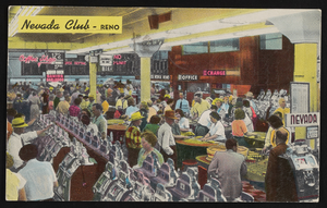
The Nevada Club in Reno, Nevada: postcard, image 001
Description

Map showing proposed new 12" well and pipe line changes at Water Springs, Las Vegas, Nevada, circa 1920
Date
Archival Collection
Description
Image

Hydrogeologic map of Nevada Test Site and vicinity, southern Nevada, 1965
Date
Description
Image