Search Results
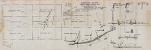
Map of the Fairday Mine, Cactus Range, Nye County (Nev.), May 25, 1916
Date
1916-05-25
Description
Scale 200 ft. to one inch.
Image
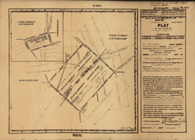
Plat map of the claim of George Wingfield (Yankee Doodle and Desert Rose Lodes), Esmeralda County (Nev.), 1910
Date
1910
Description
Plat map of the claim of George Wingfield (Yankee Doodle and Desert Rose Lodes), Esmeralda County (Nev.), 1910
Image

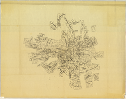
Plat of the Texas and Lone Star Lodes, Goldfield (Nev.), November 11, 1905
Date
1905-11-11
Description
Caption: U.S. Surveyor General for Nevada plat for mining claim
Image
William J. Moore Jr. Mining and Real Estate Papers
Identifier
MS-00224
Abstract
The William J. Moore Jr. papers (1925-1974) consist of mining publications, maps of mine locations, production reports, agreements, sales contracts of various ores, property claims, and correspondence. Also included are housing plans, maps, agreements, and financial papers for Westchester Gardens housing tract in Las Vegas, Nevada, estimates and analysis for a 500 room Las Vegas resort hotel.
Archival Collection
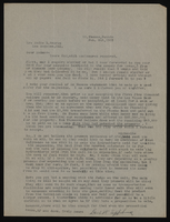
Correspondence, Levi Syphus to Sadie George
Date
1925-02 to 1925-03
Archival Collection
Description
This folder is from the "Correspondence" file of the Sadie and Hampton George Papers (MS-00434)
Text
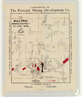
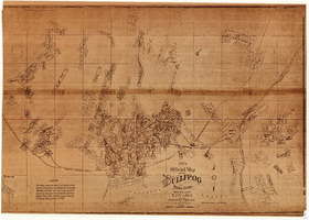
Map of the Bullfrog Mining District, Nye County (Nev.), 1905
Date
1905
Description
Scale [ca. 1:39,000. 1 in. to approx. 3,250 feet] ; 1 map : col. ; 45 x 38 cm ; Relief shown by hachures ; "Compliments of the Forward Mining Development Co." ; Properties owned by Patrick Investment Company are marked in red ; Shows railroads, roads, and pipelines ;
Image
New official map of the Bullfrog Mining District, Nye County (Nev.), 1905
Date
1905
Description
Scale [ca. 1:16,800. 1 inch to approximately 1,400 feet] ; 1 map ; 74 x 109 cm ; Blueline print ; Scale almost illegible ; "Photo. lith. Britton & Rey." ; Photocopy? [United States : s.n., 199-?] ;
Image
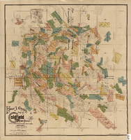
Elmer J. Chute's Map of Goldfield Mining District, Esmeralda and Nye Counties (Nev.), 1905
Date
1905
Description
Scale [ca. 1:20, 400. 1 in.=aprrox. 1,700 feet] ; 1 map : col. ; 60 x 58 cm ; Includes inset location map ; Includes township and range grid ;
Image
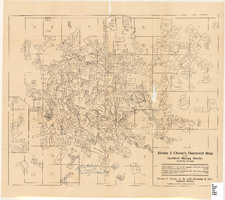
Elmer J. Chute's Diamond Map of the Goldfield Mining District, Esmeralda and Nye Counties (Nev.), 1907
Date
1907
Description
Elmer J. Chute's Diamond Map of the Goldfield Mining District, Esmeralda and Nye Counties (Nev.), 1907
Image
Map of the Tonopah Mining District, Nye County (Nev.), 1905
Date
1905
Description
Scale [ca.1:12,804. 1 in. to approx. 1,067 ft.] ; 1 map ; on sheet 92 x 106 cm ; Relief shown by hachures ; Title supplied by cataloger ; Probably a preliminary black and white edition of the colored map copyrighted by Bradford and Bradford in 1905
Image