Copyright & Fair-use Agreement
UNLV Special Collections provides copies of materials to facilitate private study, scholarship, or research. Material not in the public domain may be used according to fair use of copyrighted materials as defined by copyright law. Please cite us.
Please note that UNLV may not own the copyright to these materials and cannot provide permission to publish or distribute materials when UNLV is not the copyright holder. The user is solely responsible for determining the copyright status of materials and obtaining permission to use material from the copyright holder and for determining whether any permissions relating to any other rights are necessary for the intended use, and for obtaining all required permissions beyond that allowed by fair use.
Read more about our reproduction and use policy.
I agree.Information
Digital ID
Permalink
Details
Member of
More Info
Rights
Digital Provenance
Publisher
Transcription
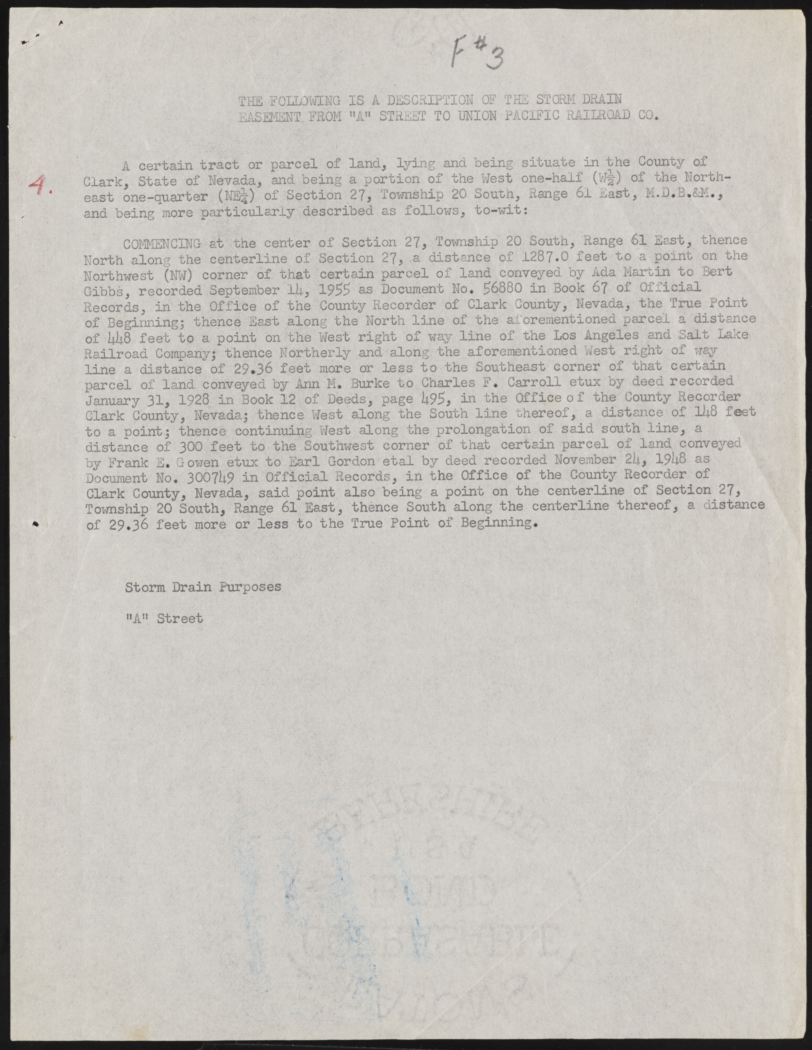
I JLlX HE FOLLOWING IS A DESCRIPTION OF THE STORM DRAIN iASEMENT. FROM "A " STREET TO UNION PACIFIC RAILROAD CO. A certain tract or parcel of land, l y i n g and being situate in the County of Clark, State of Nevada, and being a portion of the West one-half (W-jjr) of the Northeast one-quarter (NE|) of Section 27, Township 20 South, Range 6l East, M.D.B.&M., and being more particularly described as follows, to-wit: COMMENCING at the center of Section 27, Township 20 South, Range 61 East, thence North along the centerline of Section 27, a distance of 1287.0 feet to a point on the Northwest (NW) corner of that certain parcel of land conveyed by Ada Martin to Bert Gibbs, recorded September lU, 1955 as Document No. 56880 in Book 67 of Official Records, in the Office of the County Recorder of Clark County, Nevada, the True Point of Beginning; thence East along the North line of the aforementioned parcel a distance of I4I48 feet to a point on the West right of way line of the Los Angeles and Salt Lake Railroad Company; thence Northerly and along the aforementioned West right of way line a distance of 29.36 feet more or less to the Southeast corner of that certain parcel of land conveyed by Ann M. Burke to Charles F. Carroll etux by deed recorded January 31, 1928 in Book 12 of Deeds, page k9$, in the Office of the County Recorder Clark County, Nevada; thence West along the South line thereof, a distance of ll+8 feet to a point; thence continuing West along the prolongation of said south line, a distance of 300 feet to the Southwest corner of that certain parcel of land conveyed by Frank E. G owen etux to Earl Gordon etal by deed recorded November 2U, 19U8 as D ocum ent No. 3007 k9 in Official Records, in the Office of the County Recorder of Clark County, Nevada, said point also being a point on the centerline of Section 27, Township 20 South, Range 61 East, thence South along the centerline thereof, a distance of 29.36 feet more or less to the True Point of Beginning. Storm Drain Purposes "A" Street

