Skip to main content
Main navigation
Finding Aids
Digital Projects
African American Experience in Las Vegas
Charles Saladino Landscape Architecture Collection
Culinary Union Photograph Collection
Dino at the Sands
Dreaming the Skyline
Entertainment
Historic Landscape of Nevada
Hoover Dam
Jamey Stillings
Menus: The Art of Dining
Nevada Test Site Oral History Project
Newspapers
Oral Histories Collection
Photograph Collections
Rebel Yell Newspaper
Showgirls
Southern Nevada: The Boomtown Years 1900-1925
Southern Nevada History in Maps
Southern Nevada Jewish Heritage Project
UNLV CSUN Records
Union Pacific Railroad Water Documents
Walking Box Ranch Collection
Welcome Home Howard
About
Request Images
Help
Provide Feedback
Special Collections Home
Search the Special Collections and Archives Portal
Search
Search
Breadcrumb
Special Collections and Archives Portal
All Digital Objects
Title
Digital Identifier
Items per page
30
60
90
Aerial photograph of small islands surrounded by water in Lake Mead's Virgin Basin: digital photograph
Image
View
Aerial photograph showing shoreline sculpted by receding waters in Lake Mead's Virgin Basin: digital photograph
Image
View
Aerial photograph showing shoreline sculpted by receding waters in Lake Mead's Overton Arm: digital photograph
Image
View
Aerial photograph of Echo Bay's land-locked launch ramp with Lake Mead in the distance: digital photograph
Image
View
Aerial photograph of Echo Bay with Lake Mead's Overton arm in the distance: digital photograph
Image
View
Aerial photograph showing shoreline sculpted by receding waters in Lake Mead's Overton arm: digital photograph
Image
View
Aerial photograph showing shoreline sculpted by receding waters in Lake Mead's Overton arm: digital photograph
Image
View
Aerial photograph of the Overton Arm looking south at Lake Mead: digital photograph
Image
View
Aerial photograph of Beacon Rock in Lake Mead's Boulder Basin looking south: digital photograph
Image
View
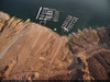
Aerial photograph of Callville Bay Marina looking south towards Boulder Basin: digital photograph
Image
View
Aerial photograph of mountains, including Pyramid Peak and Saddle Mountain, with Lake Mead's Virgin Basin in the background: digital photograph
Image
View
Aerial photograph of Echo Hills near Lake Mead's Temple Basin: digital photograph
Image
View
Aerial photograph at receding shoreline along Lake Mead's Temple Basin looking north: digital photograph
Image
View
Aerial photograph at receding shoreline along Lake Mead's Temple Basin: digital photograph
Image
View
Aerial photograph looking southwest at Lake Mead's Temple Basin: digital photograph
Image
View
Aerial photograph looking northwest at Lake Mead's Temple Basin: digital photograph
Image
View
Aerial photograph of Temple Bar Marina on Lake Mead: digital photograph
Image
View
Aerial photograph looking east at Lake Mead's Temple Basin: digital photograph
Image
View
Aerial photograph looking northwest at Lake Mead's Temple Basin: digital photograph
Image
View
Aerial photograph looking northwest at Lake Mead's Virgin Canyon near Temple Bar: digital photograph
Image
View
Aerial photograph looking south at the Temple Basin in Lake Mead: digital photograph
Image
View
Aerial photograph of receding shoreline looking west in Gregg Basin of Lake Mead: digital photograph
Image
View
Aerial photograph showing silt carried by the rapid flow of the Colorado River where it enters the still waters of Lake Mead: digital photograph
Image
View
Aerial photograph of Hoover Dam as seen from downstream: digital photograph
Image
View
Aerial photograph from above Lake Mead showing the "bathtub ring" revealed by low water levels: digital photograph
Image
View
Aerial photograph from above Lake Mead showing the "bathtub ring" revealed by low water levels: digital photograph
Image
View
Aerial photograph from above Lake Mead's Hemenway Harbor showing the "bathtub ring" revealed by low water levels: digital photograph
Image
View
Aerial photograph of Lake Mead's Hemenway Harbor with the Las Vegas Boat Harbor and Lake Mead Marinas: digital photograph
Image
View
Aerial photograph looking north from near Fortification Hill on the Arizona side of Lake Mead: digital photograph
Image
View
Aerial photograph looking south towards Hoover Dam from above Fortification Hill on the Arizona side: digital photograph
Image
View
Pagination
First page
« First
Previous page
‹‹
…
Page
24
Page
25
Page
26
Page
27
Current page
28
Page
29
Page
30
Page
31
Page
32
…
Next page
››
Last page
Last »