Skip to main content
Main navigation
Finding Aids
Digital Projects
African American Experience in Las Vegas
Charles Saladino Landscape Architecture Collection
Culinary Union Photograph Collection
Dino at the Sands
Dreaming the Skyline
Entertainment
Historic Landscape of Nevada
Hoover Dam
Jamey Stillings
Menus: The Art of Dining
Nevada Test Site Oral History Project
Newspapers
Oral Histories Collection
Photograph Collections
Rebel Yell Newspaper
Showgirls
Southern Nevada: The Boomtown Years 1900-1925
Southern Nevada History in Maps
Southern Nevada Jewish Heritage Project
UNLV CSUN Records
Union Pacific Railroad Water Documents
Walking Box Ranch Collection
Welcome Home Howard
About
Request Images
Help
Provide Feedback
Special Collections Home
"Access to archival materials stored in LASR may be limited at this time."
Search the Special Collections and Archives Portal
Search
Search
Breadcrumb
Special Collections and Archives Portal
Land use
No description.
Authority Sources
Library of Congress Subject Headings
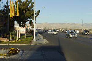
Traffic flows on Sunset Road near Eastern Avenue, looking west-southwest in Las Vegas, Nevada: digital photograph
Image
View
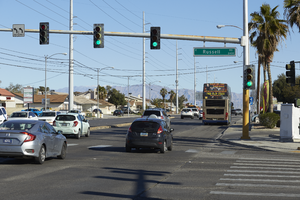
Traffic on Eastern Avenue at Russell Road, looking north in Las Vegas, Nevada: digital photograph
Image
View
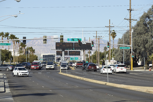
Traffic on Russell Road at Eastern Avenue, looking west-southwest in Las Vegas, Nevada: digital photograph
Image
View
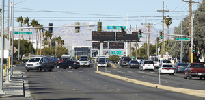
Traffic on Russell Road at Eastern Avenue, looking west-southwest in Las Vegas, Nevada: digital photograph
Image
View
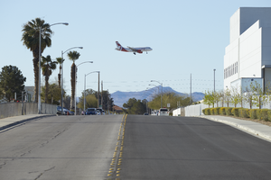
An airplane approaches McCarran International Airport as seen from Euclid Street and Russell Road, looking south-southeast in Las Vegas, Nevada: digital photograph
Image
View
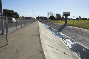
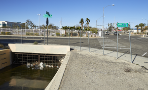
A flood control channel on Russell Road at Euclid Street sits adjacent to Helen C. Cannon Junior High School, looking east-northeast in Las Vegas, Nevada: digital photograph
Image
View
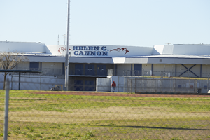
Helen C. Cannon Junior High School as seen from Russell Road near Euclid Street sits adjacent to, looking south-southeast in Las Vegas, Nevada: digital photograph
Image
View
A flood control channel on Russell Road at Euclid Street sits adjacent to Helen C. Cannon Junior High School, looking east in Las Vegas, Nevada: digital photograph
Image
View
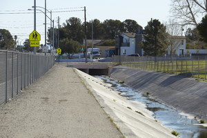
A flood control channel on Russell Road at Euclid Street, looking west-southwest in Las Vegas, Nevada: digital photograph
Image
View
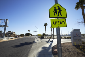
A school crossing sign on Russell Road near Eastern Avenue, looking east in Las Vegas, Nevada: digital photograph
Image
View
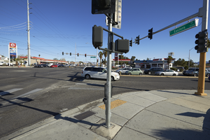
The intersection Eastern Avenue and Russell Road, looking north-northwest in Las Vegas, Nevada: digital photograph
Image
View
The intersection Eastern Avenue and Russell Road, looking north in Las Vegas, Nevada: digital photograph
Image
View
A business building on Eastern Avenue near Russell Road, looking southeast in Las Vegas, Nevada: digital photograph
Image
View
Signage for a Southwest Medical facility on Eastern Avenue near Russell Road, looking east-southeast in Las Vegas, Nevada: digital photograph
Image
View
Signage for the Aviation Insitute of Maintenance at 5870 Eastern Avenue near Oquendo Road, looking north in Las Vegas, Nevada: digital photograph
Image
View
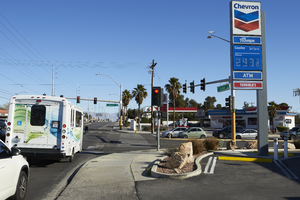
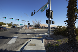
Intersection of Eastern Avenue and Oquendo Road, looking north-northeast in Las Vegas, Nevada: digital photograph
Image
View
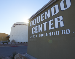
Signage for the Oquendo Center at Eastern Avenue and Oquendo Road, looking east-southeast in Las Vegas, Nevada: digital photograph
Image
View
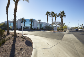
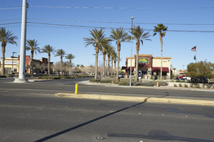
Businesses in the McCarran Marketplace on Eastern Avenue north of Patrick Lane, looking west-southwest in Las Vegas, Nevada: digital photograph
Image
View
Pagination
First page
« First
Previous page
‹‹
…
Page
35
Page
36
Page
37
Page
38
Current page
39
Page
40
Page
41
Page
42
Page
43
…
Next page
››
Last page
Last »