Skip to main content
Main navigation
Finding Aids
Digital Projects
African American Experience in Las Vegas
Charles Saladino Landscape Architecture Collection
Culinary Union Photograph Collection
Dino at the Sands
Dreaming the Skyline
Entertainment
Historic Landscape of Nevada
Hoover Dam
Jamey Stillings
Menus: The Art of Dining
Nevada Test Site Oral History Project
Newspapers
Oral Histories Collection
Photograph Collections
Rebel Yell Newspaper
Showgirls
Southern Nevada: The Boomtown Years 1900-1925
Southern Nevada History in Maps
Southern Nevada Jewish Heritage Project
UNLV CSUN Records
Union Pacific Railroad Water Documents
Walking Box Ranch Collection
Welcome Home Howard
About
Request Images
Help
Provide Feedback
Special Collections Home
"Access to archival materials stored in LASR may be limited at this time."
Search the Special Collections and Archives Portal
Search
Search
Breadcrumb
Special Collections and Archives Portal
San Bernardino County
Authority Link
GeoNames
No description.
Latitude/Longitude
34.84143, -116.17846
Feature
second-order administrative division
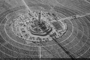
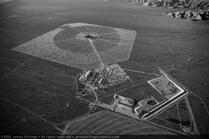
Photograph of tower, power block, and field of Unit 3 prior to heliostat installation, October 27, 2012
Image
View
Photograph of Ivanpah Units 1, 2, and 3 at sunrise, October 27, 2012
Image
View
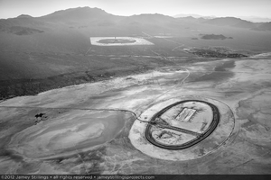
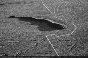
Photograph of dirt racetrack of Ivanpah dry lake bed, June 5, 2012
Image
View
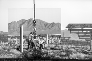
Photograph of workers installing a heliostat for Unit 1, June 4, 2012
Image
View
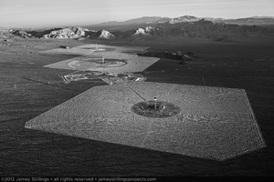
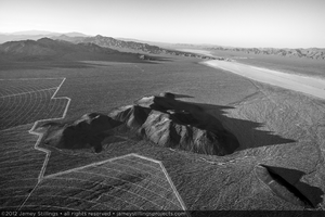
Photograph of Units 2 and 3 skirting the base of a hill rising above alluvial slope with Primm, Nevada to the north, June 2, 2012
Image
View
Photograph of heliostats near project boundary of Unit 1, June 2, 2012
Image
View
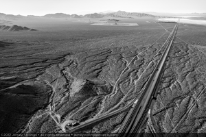
Photograph of Interstate 15 running north toward Primm and Las Vegas, Nevada with Ivanpah in the distance, June 2, 2012
Image
View
Photograph of detail of concentric service roads in Unit 3, June 2, 2012
Image
View
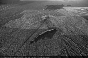
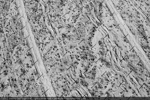
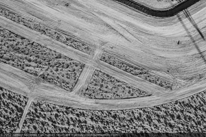
Photograph of service roads, other vehicle tracks, and pylon shadows prior to heliostat installation, June 2, 2012
Image
View
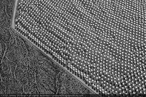
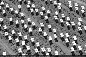
Photograph of installed heliostats in horizontal or "safe mode", June 2, 2012
Image
View
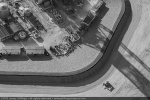
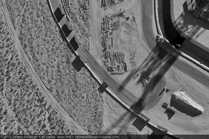
Photograph of detail of Unit 2 power block construction, April 11, 2012
Image
View
Photograph of Unit 2 power block construction, April 11, 2012
Image
View
Photograph of Unit 3, April 11, 2012
Image
View
Photograph of view south of Unit 1 construction with Unit 2 in the foreground, April 11, 2012
Image
View
Photograph of Unit 2 power block construction, January 6, 2012
Image
View
Photograph of earth excavation and ground preparation of Unit 3, January 6, 2012
Image
View
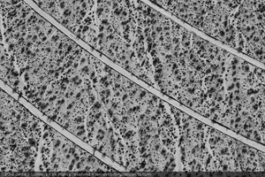
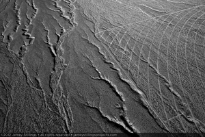
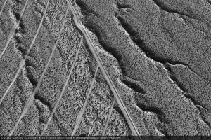
Photograph of natural erosion gullies of alluvial slope overlap with boundary and service roads of Unit 2, January 6, 2012
Image
View
Photograph of natural erosion gullies of alluvial slope overlap with boundary and service roads of Unit 2, January 6, 2012
Image
View
Pagination
First page
« First
Previous page
‹‹
…
Page
10
Page
11
Page
12
Page
13
Page
14
Page
15
Current page
16
Page
17
Page
18
Next page
››
Last page
Last »