Skip to main content
Main navigation
Finding Aids
Digital Projects
African American Experience in Las Vegas
Charles Saladino Landscape Architecture Collection
Culinary Union Photograph Collection
Dino at the Sands
Dreaming the Skyline
Entertainment
Historic Landscape of Nevada
Hoover Dam
Jamey Stillings
Menus: The Art of Dining
Nevada Test Site Oral History Project
Newspapers
Oral Histories Collection
Photograph Collections
Rebel Yell Newspaper
Showgirls
Southern Nevada: The Boomtown Years 1900-1925
Southern Nevada History in Maps
Southern Nevada Jewish Heritage Project
UNLV CSUN Records
Union Pacific Railroad Water Documents
Walking Box Ranch Collection
Welcome Home Howard
About
Request Images
Help
Provide Feedback
Special Collections Home
Search the Special Collections and Archives Portal
Search
Search
Breadcrumb
Special Collections and Archives Portal
Las Vegas Valley
Authority Link
GeoNames
Broader
Clark County
Feature
valley
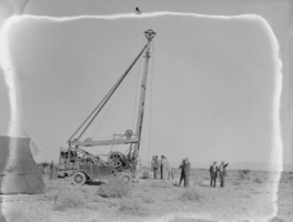
Film transparency of a group of unidentified men drilling for oil in the Las Vegas valley, Nevada, circa 1930-1932
Image
View
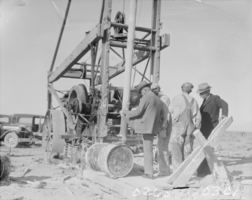
Film transparency of a group of unidentified men drilling for oil in the Las Vegas valley, Nevada, circa 1930-1932
Image
View
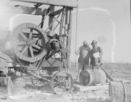
Film transparency of two unidentified men drilling for oil in the Las Vegas valley, Nevada, circa 1930-1932
Image
View
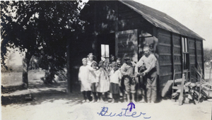
Photograph of Paradise Valley School, Nevada, circa 1916
Image
View
Film transparency of Ladd Resort, Nevada, circa early 1900s
Image
View
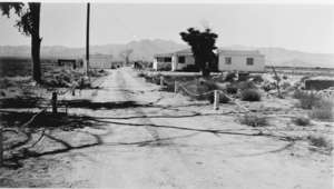
Film transparency of the Old Eglington Ranch, Nevada, September 1941
Image
View
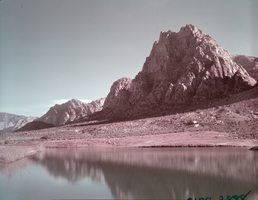
Film transparency of a desert view, circa late 1930s-1950s
Image
View
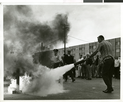
Photograph of a fire prevention demonstration outside of the Sands Hotel, Las Vegas, October 3, 1968
Image
View
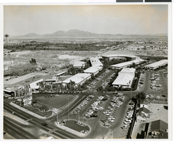
Aerial photograph of the Sands Hotel and Casino, Las Vegas, 1964
Image
View
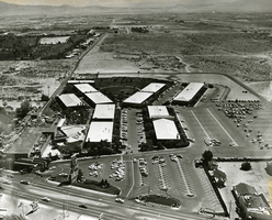
Aerial photograph of the Sands Hotel, Las Vegas, 1962
Image
View
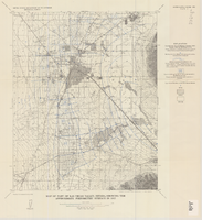
Map of Las Vegas Valley, Clark County, Nevada, October 1, 1940
Image
View
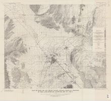
Map of part of Las Vegas Valley, Nevada, showing changes in the land-surface altitude, 1935 to 1940-41
Image
View
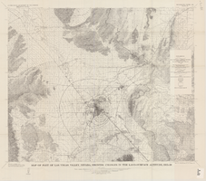
Map of part of Las Vegas Valley, Nevada, showing changes in the land-surface altitude, 1935-50
Image
View
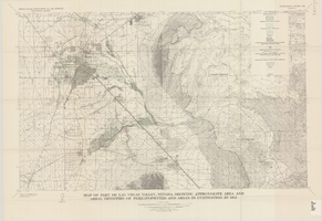
Map of part of Las Vegas Valley, Nevada, showing approximate area and areal densities of phreatophytes and areas in cultivation in 1912
Image
View
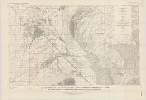
Map of part of Las Vegas Valley, Nevada, showing approximate area of phreatophytes before ground-water development
Image
View
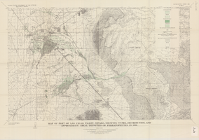
Map of part of Las Vegas Valley, Nevada, showing types, distribution, and approximate areal densities of phreatophytes in 1955
Image
View
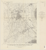
Map of part of Las Vegas Valley, Nevada, showing the approximate altitude of the water table in the near-surface reservoir in February 1956
Image
View
Map of part of Las Vegas Valley, Nevada, showing the approximate piezometric surface in 1912
Image
View
Pagination
First page
« First
Previous page
‹‹
Page
1
Page
2
Page
3
Page
4
Page
5
Page
6
Current page
7
Page
8
Page
9
Next page
››
Last page
Last »