Search the Special Collections and Archives Portal
Search Results
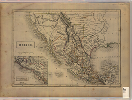
Map of Mexico, circa 1830s-1840s
Date
1830 to 1849
Description
'Engraved by S. Hall, Bury Strt., Bloomsby.' Inset map: Guatimala [sic] (including Honduras and Belize). Includes area of Southwestern states. Scale [ca. 1:12,400,000. 1 in. to approx. 200 miles] (W 125°-- W 85°/N 40°--N 15°). Relief shown by hachures. Prime meridian: Greenwich. Hand colored. 'XLIX'--outside of border at the lower right-hand. Published between 1836 and 1845?
Image
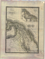
Map of Mexico and Central America, 1842
Date
1842
Description
'Dresseé par M. Lapie, Colonel d'Etat Major. Et M. Lapie fils Capitaine au même Corp. Paris, 1842. Chez P.C. Lehuby Libre. Rue de Seine No. 53.' Scale [ca. 1:9,504,000. 1 in. to approx. 15 miles]. Relief shown by hachures. Prime meridian: Paris. Hand colored. 'Atlas universel 44e'--Upper margin. Probably from P. Lapie and A.É. Lapie's Atlas universel de géographie ancienne et moderne. Inset map: Carte du Guatemala ou provinces-unies de L'Amérique Centrale. P.C. Lehuby
Image
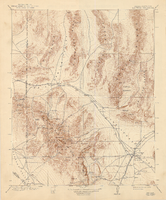
Topographic map of the Las Vegas Valley and surrounding northern and western mountain ranges, 1943
Date
1943
Description
'Edition of Mar. 1908, reprinted 1943.' 'E.M. Douglas, Geographer in charge. Topography and triangulation by R.H. Chapman, B.D. Stewart, J.E. Blackburn and D.F.C. Moor. Surveyed in 1906-1907.' Scale 1:250,000 ; polyconic proj. (W 116°00´--W 115°00´/N 37°00´--N 36°00´). Relief shown by contours and spot heights. 'Contour interval 100 feet.' 'Datum is mean sea level.' Includes township and range lines. Text and illustrations from the Topographic maps of the United States series on verso. Series: The topograhic maps of the United States. Map includes the Desert Range; Sheep Range; Pintwater Range; Las Vegas Range; Spring Mountains; Indian Springs Valley; Spotted Range. United States, Dept. of the Interior, Geological Survey
Text

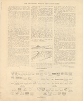
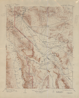
Topographic map of the Furnace Creek quadrangle, Nevada and California, 1947
Date
1947
Description
'E.M. Douglas, geographer. R.H. Chapman, in charge of section. Topography by R.H. Chapman, B.D. Stewart, J.E. Blackburn and D.F.C. Moor. Traingulation by R.H. Chapman and D.F.C. Moor. Surveyed in1905-1906.' 'Edition of Apr. 1910, reprinted 1947.' Scale 1:250,000 ; polyconic proj. (W 117°00´--W 116°00´/N 37°00´--N 36°00´). Relief shown by contours and spot heights. 'North American datum.' 'Contour interval 100 feet.' 'Datum is mean sea level.' Text and illustrations from the Topographic maps of the United States series on verso. Series: The topograhic maps of the United States. United States, Dept. of the Interior, Geological Survey
Text
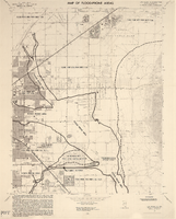
Maps of flood-prone areas in Las Vegas, Nevada, 1973
Date
1973
Description
'Prepared by the U.S. Department of the Interior, Geological Survey, in cooperation with the U.S. Department of Housing and Urban Development, Federal Insurance Administration. 1973.' Sheet 1: Las Vegas NE, Nev.; Sheet 2: Las Vegas SE, Nev.; Sheet 3:Las Vegas SW, Nev.; Sheet 4: Las Vegas NW, Nev. Published by Geological Survey (U.S.). Scale 1:24,000. [1 in. to approx. 2,000 ft.]. Relief shown by contours. Flood information overprinted on U.S. Geological Survey 7.5 minute topographic quadrangles: [sheet 1] Las Vegas NE quadrangle, [sheet 2] Las Vegas SE quadrangle, [sheet 3] Las Vegas SW quadrangle, [sheet 4] Las Vegas NW quadrangle, 1967. Shows areas subject to flooding by a flood that has 1 in 100 chance on the average of occurring in any one year. "Flood boundaries were estimated from: regional stage-frequency relations." Includes notes.
Image
Las Vegas NE quadrangle
Date
1973
Description
'Prepared by the U.S. Department of the Interior, Geological Survey, in cooperation with the U.S. Department of Housing and Urban Development, Federal Insurance Administration. 1973.'
Image
Pagination
Refine my results
Content Type
Creator or Contributor
Subject
Archival Collection
Digital Project
Resource Type
Year
Material Type
Place
Language
Records Classification


