Search Results
Map showing water connection for T. W. Sloan & Co., Moapa, Nevada, December 28, 1914
Date
Archival Collection
Description
Image
Map showing location of water-bearing lands to be sold to the Las Vegas Valley Water District, March 1, 1953
Date
Archival Collection
Description
Image

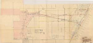
Map showing proposed new 12" well and pipe line changes at Water Springs, Las Vegas, Nevada, circa 1920
Date
Archival Collection
Description
Image
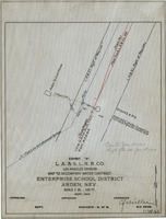
Map to accompany water contract, Enterprise School District, Arden, Nevada, September 1919
Date
Archival Collection
Description
Image
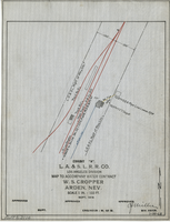
Map to accompany water contract, W. S. Cropper, Arden, Nevada, September 1919
Date
Archival Collection
Description
Image

Blueprint map showing proposed new 12" well and pipe line changes at water springs, Las Vegas, Nevada, circa 1920
Date
Archival Collection
Description
Image
Maps showing sales of water production facilities of the Union Pacific Railroad Company and water distribution facilities of the Las Vegas Land and Water Co. to the Las Vegas Valley Water District, April 29, 1953
Date
Archival Collection
Description
Image
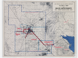
Map showing improvements made to the Las Vegas Valley Water District and vicinity under $8,700,000 bond issue,circa 1957
Date
Description
Image

Map showing water connection for Moapa School District No. 17, Moapa, Nevada, August 1920
Date
Archival Collection
Description
Image
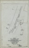
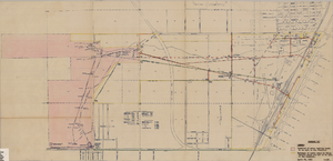
Map showing location of proposed water line to be installed along Los Angeles & Salt Lake Railroad Co. Track No. 8, Las Vegas, Nevada, May 1, 1931
Date
Archival Collection
Description
Label in lower right coner: 'Union Pacific System. Los Angeles & Salt Lake Railroad Co. Form 30, No. 6-4002. Las Vegas, Nevada. Location of proposed water line to be installed along Track No. 8. Scale 1" = 100'. Chief Engineer's Office, L.A. & S.L.R.R. Co., Los Angeles, Caif. May 1, 1931. Dwg. No. 36103.' Handwritten in red pencil on label: 'W.O. 9798.' Accompanies: Work Order Authority for Extensions and Additions to Exisiting Property, Los Angeles & Salt Lake Railroad Co., May 1, 1931. (Box 25 Folder 80-12).
Image