Search Results
Las Vegas Boulevard/Las Vegas Strip b-roll footage during the day: video
Date
Archival Collection
Description
B-roll footage of the Las Vegas Strip during the day; begins with the Silverbird; camera cuts out and it restarts at Circus Cirus; additional casinos are visible as the car travels south on the boulevard; including the Stardust, Riveria, Sahara, Dunes, Holiday Inn; Flamingo, MGM, and others. Original media U-matic S, color, aspect ratio 4 x 3, frame size 720 x 486. From The Production Company Audiovisual Collection (MS-00930) -- Digitized audiovisual material file.
Moving Image
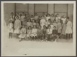
Photograph of Las Vegas School students, Las Vegas, Nevada, 1910
Date
Archival Collection
Description
Image
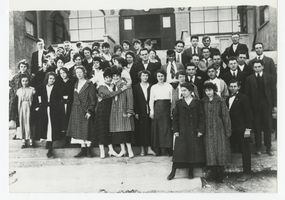
Photograph of the students and faculty at Las Vegas School, Las Vegas (Nev.), 1917
Date
Archival Collection
Description
Image
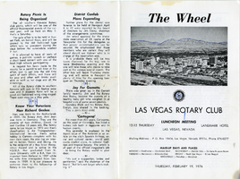
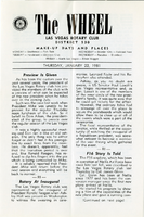
The Wheel Las Vegas Rotary Club newsletter, February 19, 1976
Date
Archival Collection
Description
Text
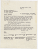
Letter from L. R. Maag (Las Vegas) to Thomas A. Campbell (Las Vegas), June 15, 1953
Date
Archival Collection
Description
Letter asking for agreement by the Las Vegas Valley Water District to allow the Las Vegas Land and Water Company to add to the purchase price of the water system, the construction costs of water mains and fire hydrants to serve Hyde park. The letter refers to a drawing that is referenced below.
Text
Las Vegas and Tonopah Railroad Blueprints
Identifier
Abstract
The Las Vegas and Tonopah Railroad Blueprints consists of twenty-four of the original thirty blueprints as part of the Interstate Commerce Commission (I.C.C.) Valuation Index Section I. They are labeled "Right-of-Way & Track Map, Las Vegas & Tonopah Railroad" and dated June 30, 1915. The blueprints contain four miles of railroad lines per sheet with a scale of 6 3/4 inches per mile. The collection also includes one sheet from the Bullfrog Goldfield Railroad company, which used the track, yard, and facilities of the Las Vegas and Tonopah and Railroad company between Beatty and Goldfield, Nevada.
Archival Collection
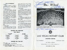
The Wheel Las Vegas Rotary Club newsletter, November 23, 1966
Date
Archival Collection
Description
Text
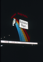
Slide of the neon sign for the Rainbow Vegas Hotel, Las Vegas, 1986
Date
Archival Collection
Description
Image
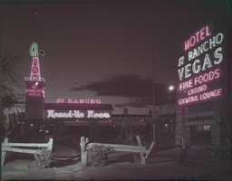
Film transparency of El Rancho Vegas, Las Vegas, 1940s-1950s
Date
Archival Collection
Description
Image
The Wheel Las Vegas Rotary Club newsletter, January 22, 1981
Date
Archival Collection
Description
Text